
On-Site Surveying, Canton of Zürich · 47.3769° N · 8.5417° E
Drone surveying Zürich.
On-site flight, orthophoto, 3D model and measurements as a checked data basis.
On-site flight from CHF 500 net · live estimate in the form · fixed quote after address and airspace check
- 278 kmfrom our Nierstein base
- 12districts and areas covered
- 12nearby places also covered
- 1contact for flight, clearance and model
Deliverables
What you receive after the flight
Instead of a photo album, you receive a measurable data product: cleanly captured, checked by a person and exported for your planning workflow.
01
Dimensioned 3D model
A measurable, georeferenced model – of a listed Old Town roof or a Glatt valley logistics site, for example. A verified geometry for CAD and BIM, not just an aerial photo.
3D model · real project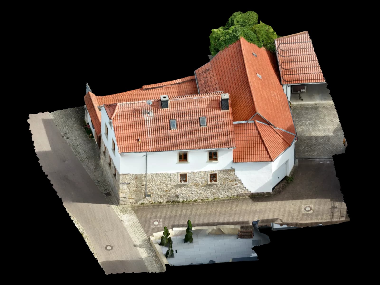
02
Georeferenced orthophoto
A rectified, true-to-scale top-down view with coordinate reference – ideal for site plans, QGIS and documenting existing and construction areas in the dense city.
Top view · real model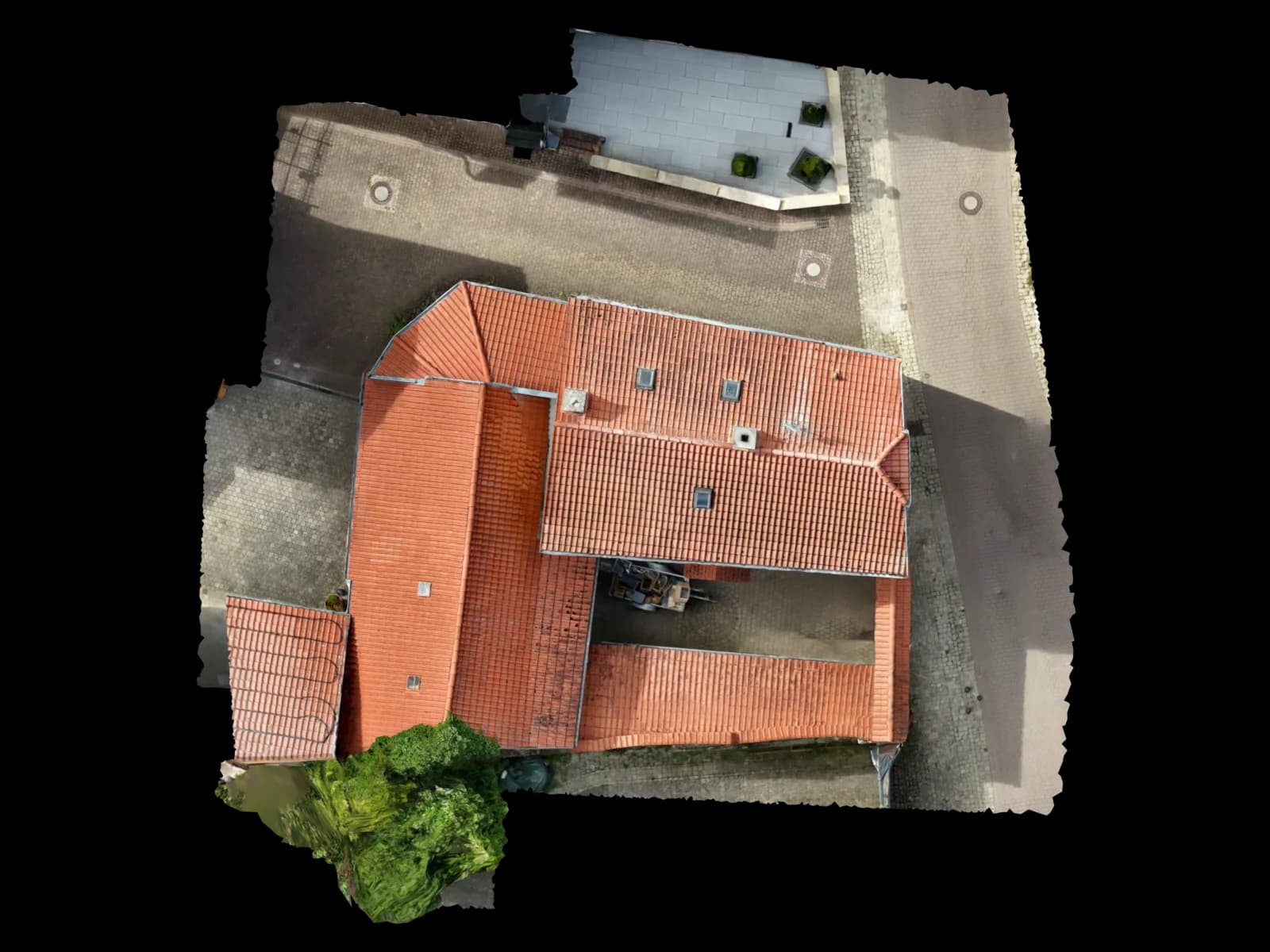
03
Area in m² and volume
Area measurement including all rooftop structures, plus volume and stockpile calculation for excavation and bulk material – such as the large pits across the Limmat valley.
File format · deliveryArea in m² and volume04
Point cloud (LAS/LAZ/E57)
A dense, coordinate-accurate point cloud in your software's standard format – especially for the terraced lakeside hillsides and complex excavation volumes in the Limmat valley.
File format · deliveryLAS · LAZ · E5705
CAD and BIM export
DXF/DWG for AutoCAD, IFC for Revit and ArchiCAD, OBJ/GLB for 3D handover – delivered software-ready instead of raw image data.
Edge drawing · real model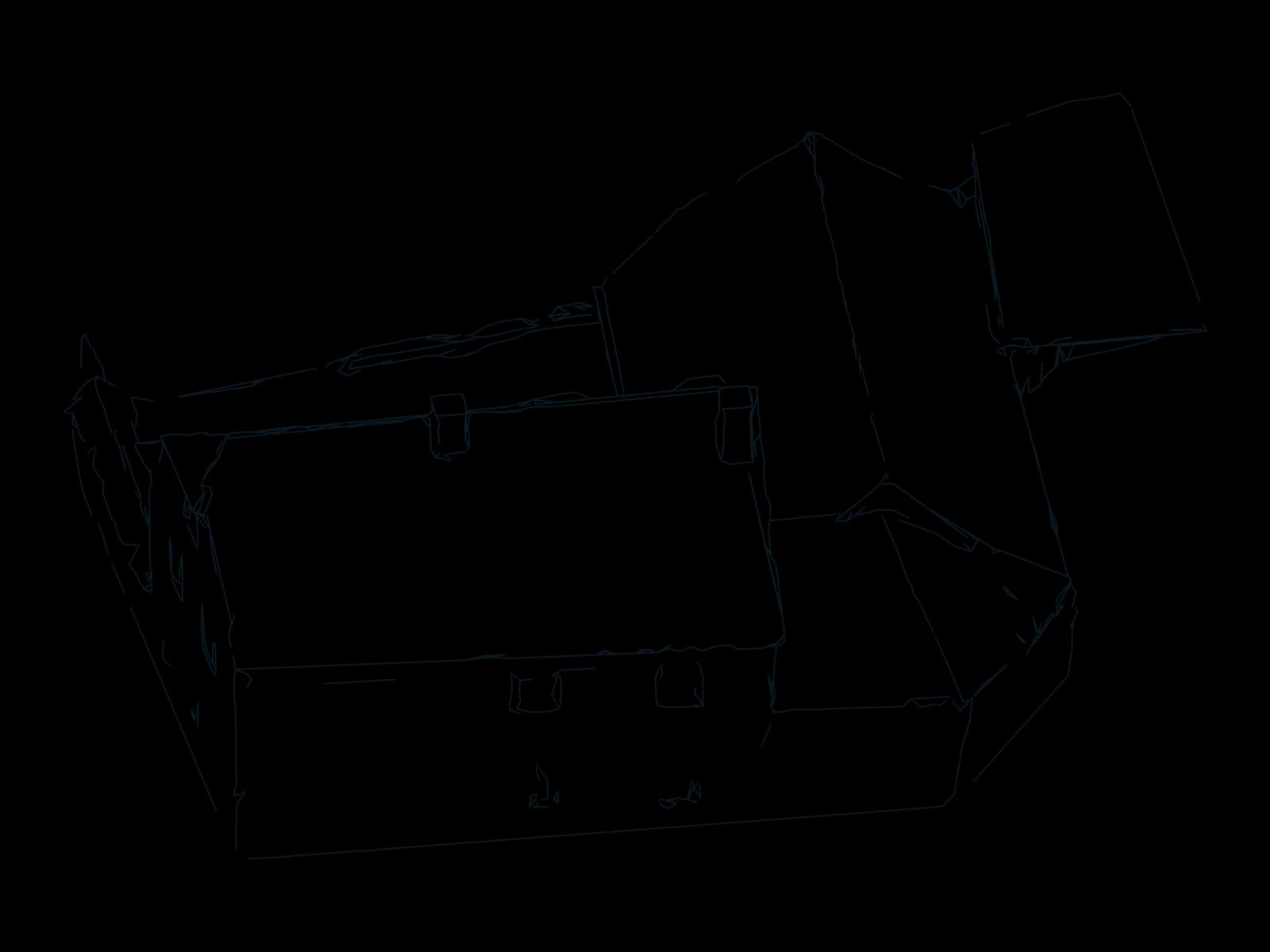
06
Shading analysis for PV
Real roof geometry plus shading from the 3D model – the basis for a robust PV layout in PV*SOL on Zürich's commercial roofs under the Energy Act.
Roof planes · real model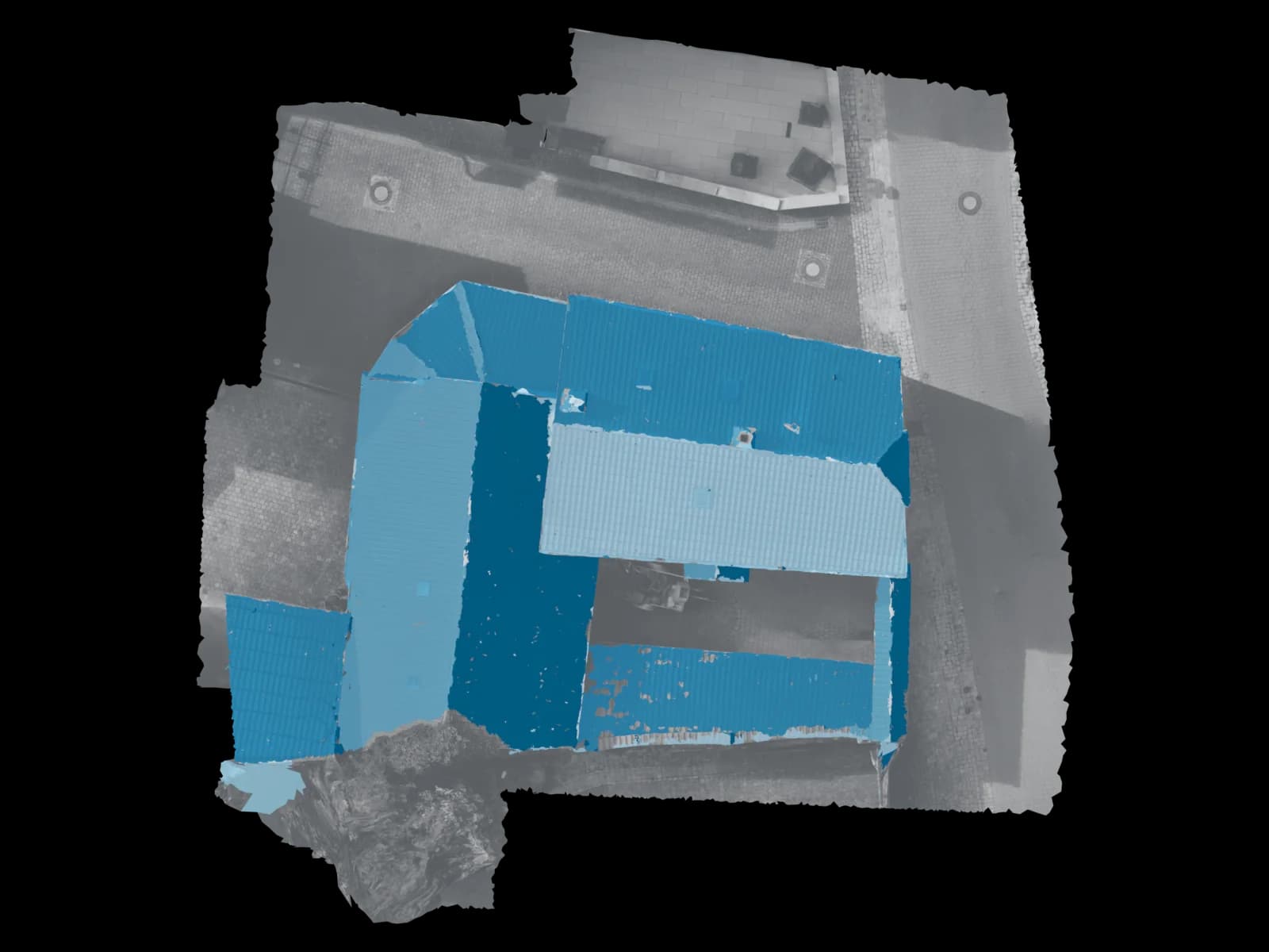
Process
How drone surveying in Zürich works
Four steps, one owner: from your request to the checked delivery.
Enquiry and geo-zone check
You tell us the site and goal. We check the geo-zone on the BAZL drone map, clarify the position relative to the Kloten/Dübendorf CTR and obtain any required Skyguide clearances.
Travel and on-site flight
We come to Zürich at the agreed time and fly your site ourselves – compliantly, with an EU competence certificate and a flight plan tailored to the task.
Processing and modelling
Photogrammetric reconstruction, georeferencing and dimensioned modelling including all structures – verified by a person before delivery.
Delivery within 48 hours
You receive the 3D model, orthophoto and measurement in your target software's format – via a viewer link, usually within 48 hours of the flight.
Request · Zürich
Calculate drone surveying in Zürich
Three short steps. The estimate updates as you go; only your fixed quote is binding.
On site in Zürich
Drone surveying in the Canton of Zürich – why on site makes a difference
Zürich is no standard area for drone flights – it sits inside two control zones at once: that of Zürich-Kloten Airport and that of the Dübendorf military airfield, where the Innovation Park Zürich is taking shape and whose CTR is coordinated with Kloten. Within roughly 5 km of the airport a permit requirement applies – flying there is only allowed with clearance from Skyguide or the airfield operator – and within the wider CTR a reduced height limit of 150 m above ground applies to drones over 0.5 kg. This is exactly where it matters that we don't just show up, but check every geo-zone on the BAZL drone map in advance, obtain the necessary clearances and plan each flight compliantly. The northern districts Oerlikon, Seebach, Affoltern and Schwamendingen, as well as Opfikon, Wallisellen and Dübendorf, are particularly affected.
In terms of substance, Zürich presents a clear demand: large, often shaded commercial and logistics flat roofs in the Limmat and Glatt valleys, under PV pressure from the Zürich Energy Act and the ewz solar drive. Add the densification and high-rise boom in Zürich-West (district 5) and the Glatt valley (Oerlikon, Opfikon-Glattbrugg, Wallisellen) with constant as-built surveys, plus the terraced hillsides along Lake Zürich – Zollikon and Küsnacht on the right-bank Gold Coast, Thalwil, Horgen and Wädenswil on the left – where classic ground surveying reaches its limits.
For every one of these sites we deliver measurable data rather than aerial photos: a dimensioned 3D model, a georeferenced orthophoto, an area measurement in m², and on request a point cloud, DXF/DWG, IFC or a shading analysis for PV planning. Everything verified by a person and in your target software's format – PV*SOL, AutoCAD, Revit, ArchiCAD or QGIS.
Service areas around Zürich
We fly on site across the city of Zürich – from the Old Town and Seefeld through Zürich-West to Altstetten and Oerlikon – and across the wider canton. We also reach the surrounding communities in the Glatt valley, the Limmat valley, along the lake and in the Zürich Oberland at short notice. For sites beyond our on-site radius, uploading images remains the direct route to the same result.
Areas covered in Zürich
Also in the surrounding area
Why Voxelia
Why drone surveying instead of a classic survey
No aerial lift, no roof access
Tall commercial and logistics roofs in the Glatt valley, closely packed high-rises in Zürich-West, or listed Old Town roofs that need elaborate scaffolding – the drone captures from the air what is expensive or inaccessible from the ground. No one has to climb the roof.
Measurable data, not just photos
You get a georeferenced, dimensioned model with an area measurement in m² – directly usable in PV*SOL, AutoCAD, Revit, ArchiCAD or QGIS, with no processing workflow of your own.
Fast and predictable
One on-site appointment, delivery usually within 48 hours. Instead of several subcontractors, one contact for flight and model – saving coordination and time in the project.
Safety & compliance
Why Voxelia 3D in Zürich
- One contact for flight AND model – from a single source
- Knowledge of the Kloten/Dübendorf control zones, geo-zone check on the BAZL drone map and Skyguide clearances before every job
- Pilot with an EU competence certificate (drone licence), insured flight
- Person-verified, georeferenced and dimensioned data, confidential image handling
- Delivery usually within 48 hours via viewer link
Drone flights in Zürich – the legal framework
Voxelia 3D combines exactly what Zürich needs: the compliant on-site flight and the modelling depth behind it. We know the Zürich airspace context – the Kloten and Dübendorf control zones, the permit requirement within the 5 km radius, the check on the BAZL drone map and clearance via Skyguide. With us you speak to one contact for flight and processing who plans every Zürich assignment to Swiss regulations; the pilot holds the EU competence certificate (drone licence).
We deliver defined, person-verified deliverables in clearly named formats – point cloud, DXF/DWG or IFC, for example – rather than vague promises, exportable to your target software such as PV*SOL or AutoCAD. Imagery over densely built quarters is handled confidentially and sparingly, and we fly insured. That makes the data immediately and worry-free usable for solar installers, architects, developers, property managers and surveying offices.
Switzerland has applied the EU drone rules since 1 January 2023, enforced by the BAZL (Federal Office of Civil Aviation). Operators are registered with the BAZL and the pilot holds the EU competence certificate. Most jobs run in the open category (A1/A2/A3) up to 120 m above ground. Large parts of Zürich lie within the control zones of Kloten and Dübendorf: within roughly 5 km of the airport a permit requirement applies – flights there are only allowed with clearance – and within the wider CTR a reduced height of 150 m applies to drones over 0.5 kg. We check the current BAZL drone map before every on-site job and obtain clearances from Skyguide or the airfield operator.
FAQ
Frequently asked questions about drone surveying in Zürich
What does drone surveying in Zürich cost?
Do you come to Zürich for the flight, or do I have to provide the images myself?
Is flying even allowed in Zürich, given Kloten and Dübendorf airports?
How accurate and dimensionally true is the survey?
Which data and formats do I receive after the flight?
Is drone surveying suitable for my PV planning in Zürich?
From our Nierstein base
Drone surveying in other locations
Sorted by distance
- NiersteinBase
- Groß-Gerau12 km
- Mainz15 km
- Rüsselsheim am Main15 km
- Raunheim18 km
- Alzey21 km
- Darmstadt23 km
- Ingelheim am Rhein23 km
- Wiesbaden24 km
- Hofheim am Taunus25 km
- Worms26 km
- Neu-Isenburg32 km
- Bingen am Rhein33 km
- Bad Kreuznach34 km
- Eschborn35 km
- Frankfurt am Main36 km
- Offenbach am Main40 km
- Bad Homburg vor der Höhe45 km
- Hanau51 km
47.3769° N · 8.5417° E · Zürich
Request an on-site flight in Zürich
Describe your site to us – we check the geo-zone, plan the flight compliantly and deliver your dimensioned 3D model usually within 48 hours. We serve the Canton of Zürich from Rheinhessen and are reachable directly at +49 151 16520282.
Upload & 3D processing
Outside the region or already have your own drone images? Upload them – we build the same verified 3D, CAD and PV data basis from them.
Upload & 3D processing