Site survey in 24 hours – no weeks of on-site work.
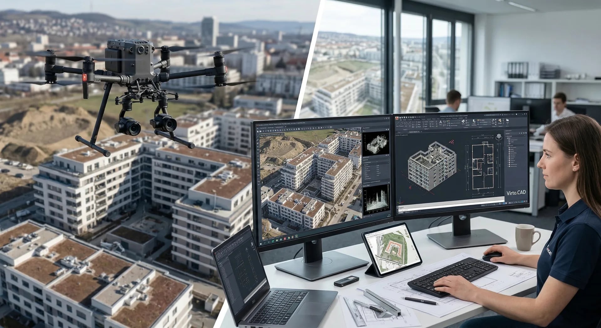
We deliver complete CAD models, point clouds, and textured 3D geometry from drone imagery – ready to use in AutoCAD, Revit, ArchiCAD, and SketchUp.
Project handoff
Your drone images. Usable project data.
You provide the imagery. We review the dataset, prepare the right measurement and model data, and deliver it so your team can keep working immediately.
Your input
- Drone images of the building (JPG/RAW/TIFF)
- Optional: floor plans or existing survey data
- Optional: RTK data for maximum accuracy
Your output
- CAD model (DWG/DXF for AutoCAD)
- Georeferenced point cloud (LAS/LAZ)
- BIM-ready file (IFC)
- Textured 3D model (OBJ/FBX)
- High-resolution orthophoto
Compatible software
Project use
As-built data your planning team can work with
You receive a digital as-built basis from drone imagery without weeks of manual site capture. Envelope, roof, facade, and relevant details are prepared so design, renovation, or refurbishment can start faster.
Deliverables are not just 3D visualizations, but usable CAD and geodata: DWG/DXF for AutoCAD, IFC for BIM workflows, point clouds for measurement, and orthophotos for site or facade reference.
How architecture teams use the data
Ready to order
Start CAD handoff directly.
Review the price, pay securely, then receive the upload link. For edge cases, we review the dataset before weak image sets are processed.
Starting price
€225
up to 1,000 m². Pre-calculated: €225
Process
How you receive your project data
Order drone flight
Building is fully documented.
3D reconstruction
Photogrammetry engine produces precise model.
CAD preparation
Model is prepared for AutoCAD, Revit, and others.
Delivery in 24h
All formats + documentation in your dashboard.
From the project side
“
M. Fischer
Architecture firm
Related resources
Architecture and CAD handoffs
As-built capture, DWG/DXF handoffs, and planning-team workflows.
Case study: architectural as-built survey
Proof for a real CAD and BIM handoff created from drone imagery.
Guides and best practices
Tips for drone flights, image quality, and data preparation.
Pricing and plans
Get started with Voxelia 3D – per-project or subscription pricing.
Start immediately
Calculate price and order directly
From €45 · Delivery in 12–24h · No account required
Next step
Request a project now
If your project fits, we clarify the dataset, required delivery, and next step.