
Drone surveying in the Nahe valley · 49.8469° N · 7.8671° E
Drone surveying Bad Kreuznach.
On-site flight, orthophoto, 3D model and measurements as a checked data basis.
On-site flight from €390 net · live estimate in the form · fixed quote after address and airspace check
- 34 kmfrom our Nierstein base
- 10districts and areas covered
- 12nearby places also covered
- 1contact for flight, clearance and model
Deliverables
Your deliverables from drone surveying
Instead of a photo album, you receive a measurable data product: cleanly captured, checked by a person and exported for your planning workflow.
01
Measurable 3D model
A measurable, georeferenced model of your object – whether a conversion site at the Gewerbepark General Rose or a listed bridge house over the Nahe. The basis for planning, take-off and documentation.
3D model · real project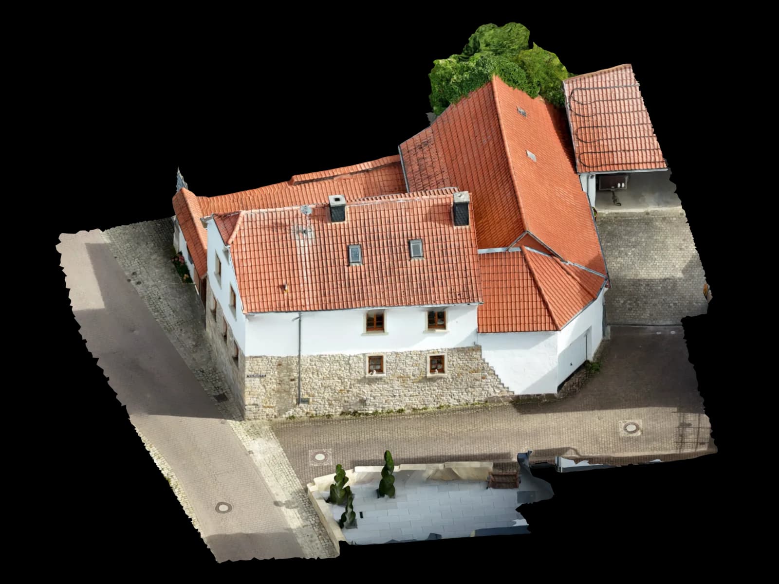
02
Georeferenced orthophoto
A true-to-scale aerial image (GeoTIFF) for site plans, area calculation and QGIS – distortion-free and measurable rather than an oblique snapshot, for example across entire warehouse areas along the B 41.
Top view · real model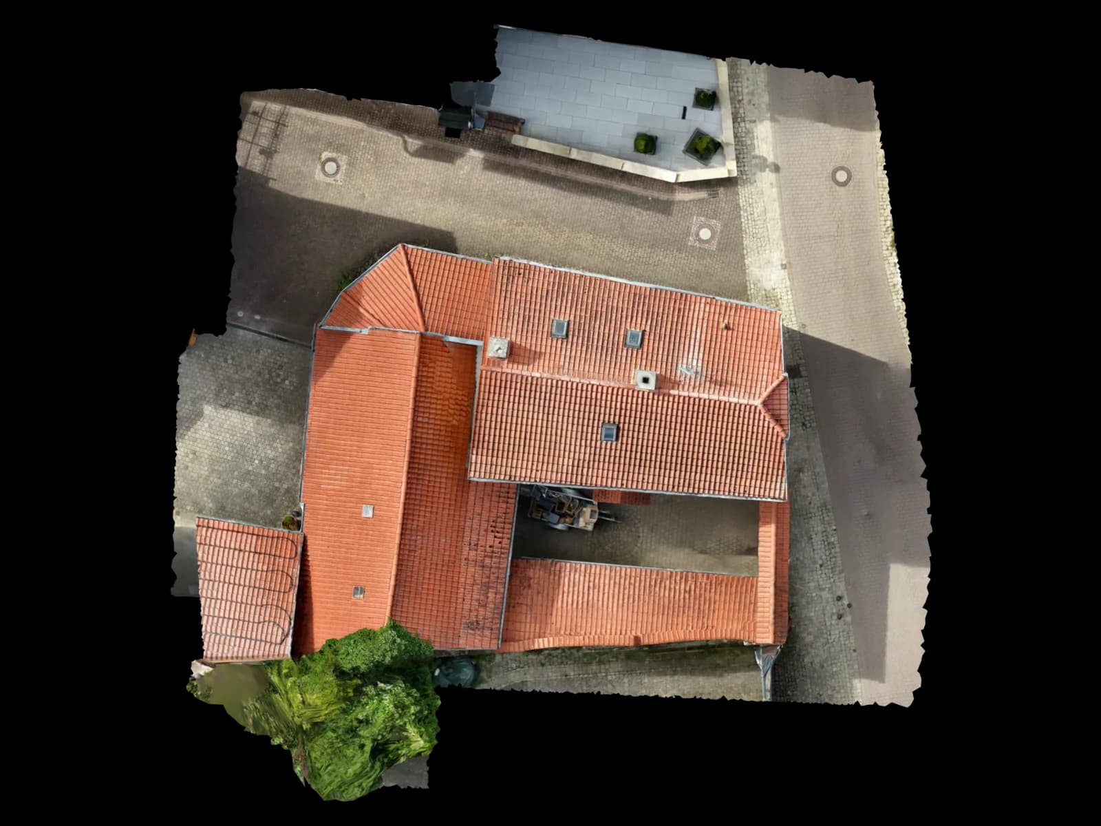
03
Area take-off in m²
Roof and ground areas measured precisely – ideal for PV layout on the large Michelin and B 41 warehouse roofs or trade quotes in the old town, with no roof access required.
File format · deliveryArea take-off in m²04
Point cloud (LAS / LAZ / E57)
A dense 3D point cloud that also captures the broken terrain of the Nahe steep slopes at the Rotenfels cleanly – ready to use directly in CAD and GIS environments.
File format · deliveryLAS · LAZ · E5705
CAD and BIM export (DXF/DWG, IFC, OBJ/GLB)
Software-ready delivery for AutoCAD, Revit and ArchiCAD – including a 3D mesh for visualisation and further editing, for example an as-built survey in the In den Weingärten quarter.
Edge drawing · real model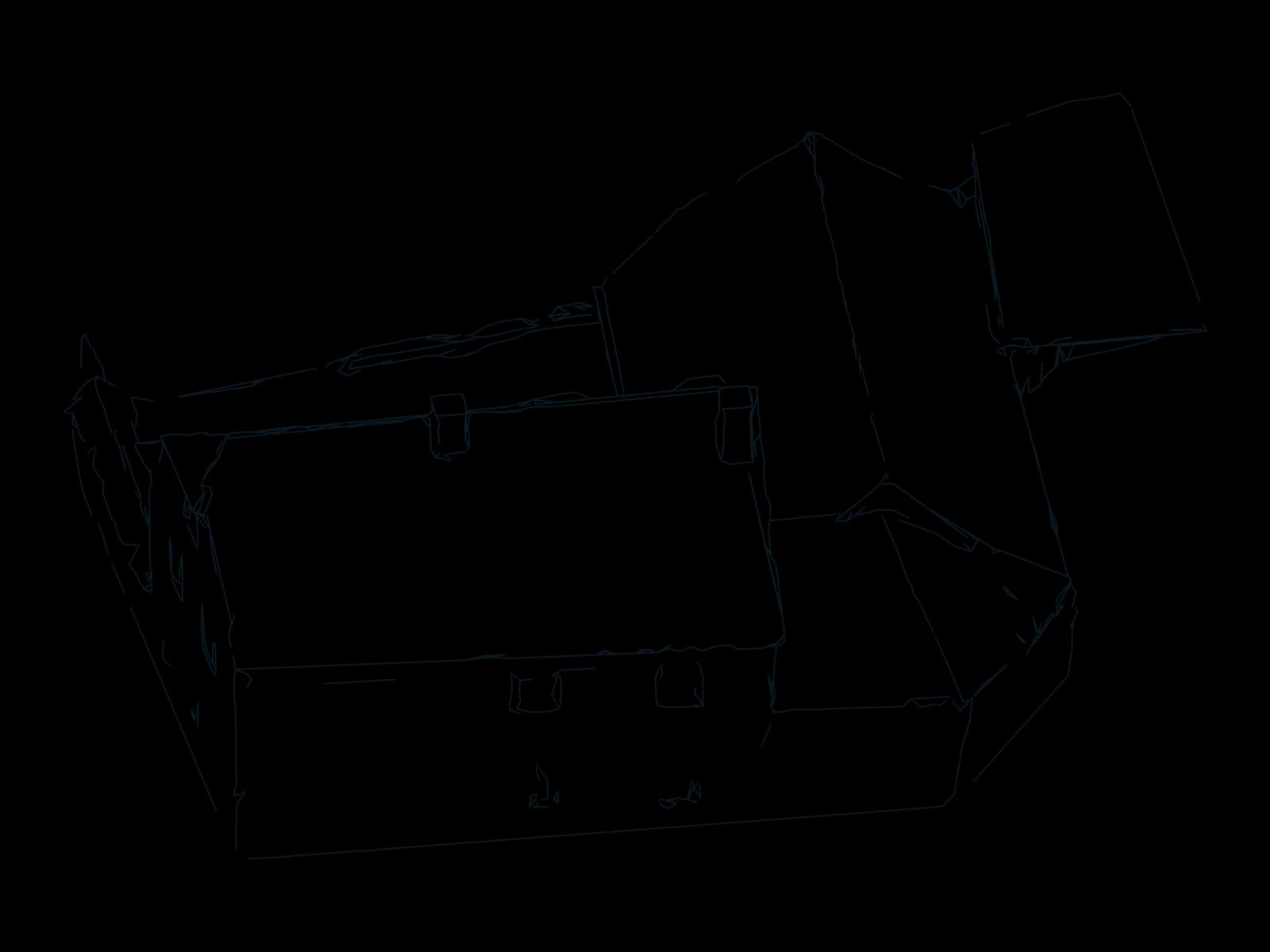
06
Volume, mass and shading
Excavation and bulk material volumes for construction on conversion sites, terrain models for the steep slopes at the Rotenfels and shading analysis for PV planning in PV*SOL.
File format · deliveryVolume, mass and shading
Process
How drone surveying in Bad Kreuznach works
Four steps, one owner: from your request to the checked delivery.
Enquiry and scheduling
You describe the object and goal; we clarify scope, geo-zones and a date. For flights near the Rotenfels or in the Nahe valley we check the nature-conservation situation in advance.
On-site flight
We come to you from Nierstein and fly the object ourselves, capturing it in full – warehouse roof, old-town façade, steep slope or construction site, without scaffolding and without anyone climbing the roof.
Evaluation and modelling
From the imagery we create the georeferenced, measurable 3D model via photogrammetry. Every dataset is checked by a person before delivery.
Delivery within 48 hours
You receive the model, orthophoto and take-off usually within 48 hours – in your software's target format, provided via a viewer link. For large industrial sites we phase delivery by construction section.
Request · Bad Kreuznach
Calculate drone surveying in Bad Kreuznach
Three short steps. The estimate updates as you go; only your fixed quote is binding.
On site in Bad Kreuznach
On site along the Nahe – from the Michelin warehouse roof to the steep slopes of the Rotenfels
Bad Kreuznach brings two surveying worlds together in a small area: the large flat warehouse roofs of the commercial zones along the B 41 near Planig and the Michelin plant on Michelinstraße on one side – and the dense, listed old town with its bridge houses over the Nahe, the Kauzenburg and the Gründerzeit spa quarter of the Neustadt around the Salinental and the Crucenia spa on the other. Add to that the steep vineyard slopes at the Rotenfels and in Winzenheim, where scaffolding, an aerial platform or a total station simply aren't an option. For each of these situations we deploy the drone deliberately.
Based in Nierstein in Rheinhessen, we reach the Nahe in roughly 30 to 40 minutes. We agree a date, fly the object on site ourselves and turn the imagery into a georeferenced, measurable 3D model – not a photo album but a survey-grade data product you can work with directly. Flight and modelling stay in one hand, so you speak to the same person about both the flight and the evaluation.
Whether it's PV planning on a commercial roof along the B 41, an as-built survey for a developer project in the young In den Weingärten quarter, or volume calculation on the Gewerbepark General Rose – the former Rose Barracks conversion site between Alzeyer Straße and Dürerstraße: we deliver the data in your software's target format. Anyone who already has their own imagery – surveying or planning offices, for example – can simply upload it and receive the finished model from us.
Service area around Bad Kreuznach
We fly on site in Bad Kreuznach and its districts as well as across the wider Nahe valley and the adjoining Rheinhessen hill country. From our base in Nierstein we reach the Nahe in roughly 30 to 40 minutes – one contact, plannable appointments. We regularly cover the following places and quarters:
Areas covered in Bad Kreuznach
Also in the surrounding area
Why Voxelia
Why drone surveying instead of a classic take-off
Where aerial platforms and scaffolding stop
On the steep vineyard slopes at the Rotenfels and in Winzenheim an aerial platform simply can't be used – the drone captures terrain and retaining walls from the air, safely and without fall risk. The same goes for hard-to-reach bridge-house roofs over the Nahe.
Complete instead of point-by-point
Rather than individual measured points we capture the entire object across its full extent – from a complete Michelin warehouse roof to the angular old-town footprint. The result is a complete, measurable model, with no follow-up measuring on site.
Fast and plannable
One on-site appointment, one flight, usually 48 hours to delivery. That is far faster than time-intensive classic surveying with several site visits.
Ready to use directly
The data arrives software-ready for PV*SOL, AutoCAD and QGIS – without conversion detours in the office, whether for PV planning on a commercial roof or the GIS take-off of a conversion site.
Safety & compliance
Why Voxelia 3D
- Regional presence: roughly 30 to 40 minutes from Nierstein to the Nahe
- One contact for the flight and the model
- Delivery usually within 48 hours, phased by construction section for industrial sites
- Person-checked, georeferenced data
- Geo-zones Rotenfels/Nahe valley and the nature-conservation authority are factored in
Drone flight and permits
With us, the flight and the modelling stay in one hand. You speak to the same person about the flight in Bad Kreuznach and about the finished evaluation – no subcontractor ping-pong between pilot and office. Our pilot holds an EU remote pilot certificate and plans the flight in compliance with the rules – including the designated geographic zones along the Rotenfels and Nahe valley and, where needed, coordination with the lower nature-conservation authority of the Bad Kreuznach district administration.
We deliver real, measurable 3D models for PV*SOL, AutoCAD and QGIS – not just aerial images. Every dataset is checked by a person and georeferenced before handover so you can work to scale.
We fly under the EU drone regulation (Regulation (EU) 2019/947); our pilot holds an EU remote pilot certificate, and the operation is registered with the Federal Aviation Office and covered by liability insurance. Entries into designated geographic zones are applied for at the responsible state aviation authority – in Rhineland-Palatinate the Landesbetrieb Mobilität (LBM), aviation unit; the place of operation is decisive. Authorisations for operations in the 'specific' category have, since 1 April 2026, been handled by the Federal Aviation Office (Luftfahrt-Bundesamt, LBA). In nature-conservation and Natura 2000 areas such as the Rotenfels or Nahe valley we additionally involve the lower nature-conservation authority of the Bad Kreuznach district administration. We handle the clearance for you.
FAQ
Frequently asked questions about drone surveying in Bad Kreuznach
What does drone surveying in Bad Kreuznach cost?
Do you come to Bad Kreuznach for the flight – or do I supply the images myself?
How quickly do I get the 3D model after the flight?
How accurate and to scale is the data?
Is this suitable for my PV planning on a commercial roof?
Do I need a permit for the drone flight on my property?
From our Nierstein base
Drone surveying in other locations
Sorted by distance
- NiersteinBase
- Groß-Gerau12 km
- Mainz15 km
- Rüsselsheim am Main15 km
- Raunheim18 km
- Alzey21 km
- Darmstadt23 km
- Ingelheim am Rhein23 km
- Wiesbaden24 km
- Hofheim am Taunus25 km
- Worms26 km
- Neu-Isenburg32 km
- Bingen am Rhein33 km
- Eschborn35 km
- Frankfurt am Main36 km
- Offenbach am Main40 km
- Bad Homburg vor der Höhe45 km
- Hanau51 km
- Zürich278 km
49.8469° N · 7.8671° E · Bad Kreuznach
Request an on-site flight in Bad Kreuznach
Tell us which object you'd like surveyed – from a warehouse roof along the B 41 to a steep slope at the Rotenfels. We come on site, fly it ourselves and deliver the measurable 3D model usually within 48 hours. No-obligation quote, one contact. Phone: +49 151 16520282.
Upload & 3D processing
Outside the region or already have your own drone images? Upload them – we build the same verified 3D, CAD and PV data basis from them.
Upload & 3D processing