
Commercial and construction surveying in Groß-Gerau district · 49.9214° N · 8.4826° E
Drone surveying Groß-Gerau.
On-site flight, orthophoto, 3D model and measurements as a checked data basis.
On-site flight from €390 net · live estimate in the form · fixed quote after address and airspace check
- 12 kmfrom our Nierstein base
- 8districts and areas covered
- 8nearby places also covered
- 1contact for flight, clearance and model
Deliverables
Survey deliverables for projects in Groß-Gerau
Instead of a photo album, you receive a measurable data product: cleanly captured, checked by a person and exported for your planning workflow.
01
Measurable 3D model
A georeferenced and manually checked building model for production buildings, business parks and logistics areas, ready for use without rebuilding the geometry from scratch.
3D model · real project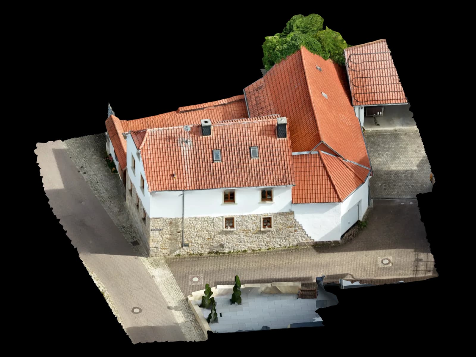
02
Georeferenced orthophoto
A true-to-scale aerial image of a plot, construction site or operating area in Groß-Gerau, available as GeoTIFF for GIS and planning documents.
Top view · real model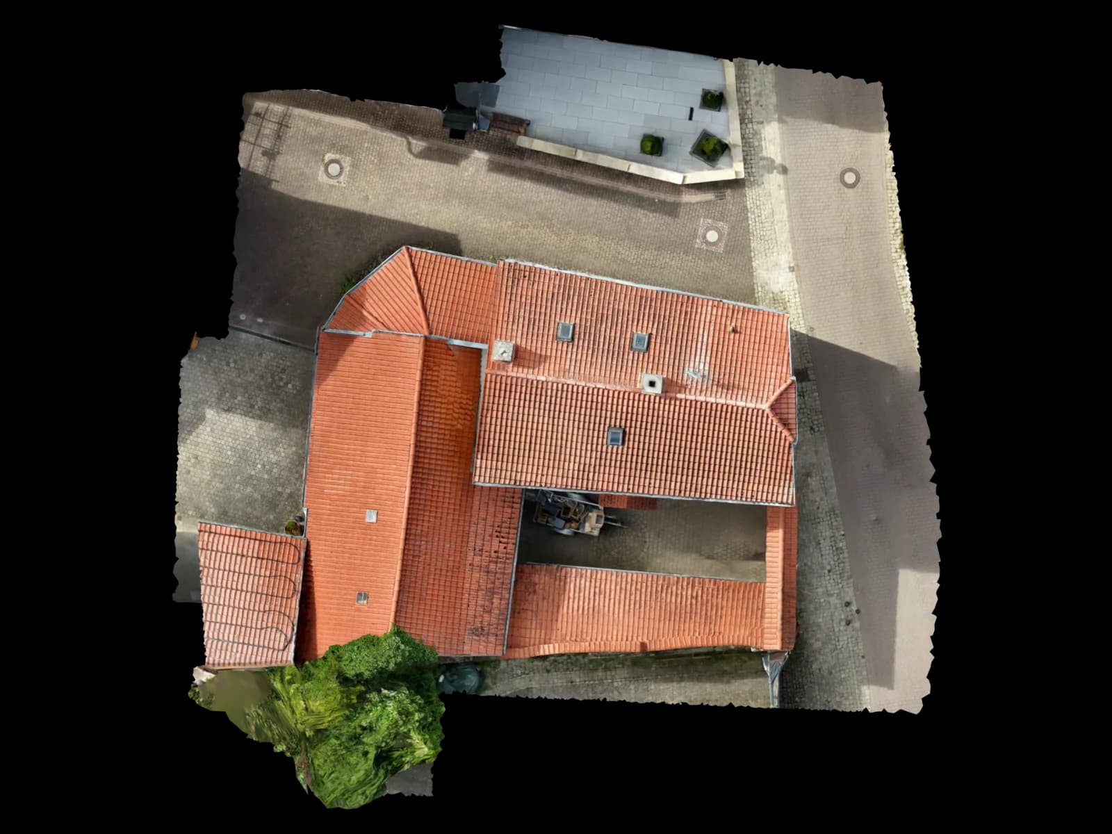
03
Roof and facade measurements
Areas, edges, slopes and heights are recorded without requiring scaffolding, a lift or a roof inspection for the initial survey.
Edge drawing · real model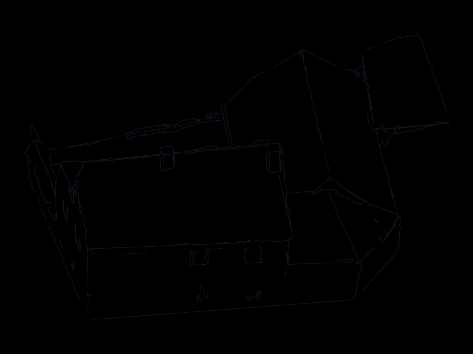
04
Point cloud for CAD and BIM
Dense LAS, LAZ or E57 point clouds for existing-condition planning, conversions and coordination on buildings and plants in Groß-Gerau.
File format · deliveryPoint cloud for CAD and BIM05
Construction progress and as-built records
Repeat flights document changes consistently and provide a clear basis for comparing planned and completed work.
File format · deliveryConstruction progress and as-built records06
Volumes, areas and solar inputs
Volumes, roof areas and shading can be derived from the same dataset and exported for estimating, planning or documentation.
File format · deliveryVolumes, areas and solar inputs
Process
How drone surveying works in Groß-Gerau
Four steps, one owner: from your request to the checked delivery.
Define the address and outcome
Send us the address in Groß-Gerau, the scope and the required deliverable. We check feasibility, airspace and site access.
Prepare the capture
We plan flight lines, safety distances, ground resolution and, where required, control points or RTK/PPK for the accuracy target.
Capture on site
We fly the site in Groß-Gerau ourselves and verify image coverage before leaving the location.
Check and deliver
After photogrammetric processing, we check geometry and completeness and provide the agreed target formats.
Request · Groß-Gerau
Calculate drone surveying in Groß-Gerau
Three short steps. The estimate updates as you go; only your fixed quote is binding.
On site in Groß-Gerau
Area-wide measurement for commercial locations around Groß-Gerau
Groß-Gerau sits between major rail and motorway corridors and combines production, trades, services and logistics. Large roofs and outdoor areas can be captured quickly without unnecessary disruption to operations.
For hall refurbishment, extensions, drainage design or solar layouts, we provide roof geometry, heights and areas in a verifiable model. Orthophoto and point cloud can supplement existing CAD and GIS records.
Repeat flights also support progress and area monitoring in Dornheim, Wallerstädten, Berkach and neighbouring business locations. Deployment planning accounts for access, operating hours and safe ground areas.
Service area in and around Groß-Gerau
We cover the full city area of Groß-Gerau and surrounding construction, commercial and residential locations. These areas and nearby towns are part of our regional deployment planning:
Areas covered in Groß-Gerau
Also in the surrounding area
Why Voxelia
Why aerial measurement works for production buildings, business parks and logistics areas
Capture more area in less time
Connected roofs, facades and outdoor areas in Groß-Gerau can be documented completely in one coordinated capture.
Avoid hazardous access
Difficult roof edges, industrial halls and existing facades can be measured without sending staff into exposed areas for the initial survey.
One dataset for multiple disciplines
Orthophoto, 3D model, point cloud and measurements come from the same capture and stay consistent across design, construction and records.
Safety & compliance
One team for capture and modelling in Groß-Gerau
- On-site service in Groß-Gerau and surrounding areas
- Address-specific airspace and feasibility check
- Manually checked 3D and geospatial data
- One contact for capture, processing and export
- Standard CAD, GIS, BIM and solar formats
Airspace and flight clearance in Groß-Gerau
Voxelia 3D plans the deployment from Nierstein, captures the site in Groß-Gerau and completes the photogrammetric processing. Flight planning, data quality and delivery formats therefore stay with one team.
Every dataset is manually checked for image coverage, geometry and plausibility before delivery. The result is a usable basis for CAD, GIS, BIM or solar design rather than a loose collection of photographs.
Proximity to Frankfurt Airport and busy transport corridors can affect permitted operations in Groß-Gerau district. Industrial facilities, rail land and local protected areas are also considered for the address. Before confirming a date, we check the exact address against the current aviation maps. Property rights, privacy, nature protection, critical infrastructure and any required clearances are handled for the specific project. We do not promise a flight without checking the address first.
FAQ
Frequently asked questions about drone surveying in Groß-Gerau
How much does a drone survey in Groß-Gerau cost?
Do you travel to Groß-Gerau for the flight?
Does a drone flight in Groß-Gerau require a permit?
How accurate is the result?
Which files are delivered?
Is the method suitable for larger commercial and construction sites in Groß-Gerau?
From our Nierstein base
Drone surveying in other locations
Sorted by distance
- NiersteinBase
- Mainz15 km
- Rüsselsheim am Main15 km
- Raunheim18 km
- Alzey21 km
- Darmstadt23 km
- Ingelheim am Rhein23 km
- Wiesbaden24 km
- Hofheim am Taunus25 km
- Worms26 km
- Neu-Isenburg32 km
- Bingen am Rhein33 km
- Bad Kreuznach34 km
- Eschborn35 km
- Frankfurt am Main36 km
- Offenbach am Main40 km
- Bad Homburg vor der Höhe45 km
- Hanau51 km
- Zürich278 km
49.9214° N · 8.4826° E · Groß-Gerau
Request drone surveying in Groß-Gerau
Send us the address, area and required output. We check feasibility in Groß-Gerau and prepare a tailored quote for capture, processing and export.
Upload & 3D processing
Outside the region or already have your own drone images? Upload them – we build the same verified 3D, CAD and PV data basis from them.
Upload & 3D processing