
Home base at the Roter Hang · 49.8697° N · 8.3364° E
Drone surveying Nierstein.
On-site flight, orthophoto, 3D model and measurements as a checked data basis.
On-site flight from €390 net · live estimate in the form · fixed quote after address and airspace check
- 0 kmas the crow flies – Nierstein is our base
- 8districts and areas covered
- 12nearby places also covered
- 1contact for flight, clearance and model
Deliverables
What you receive after the flight
Instead of a photo album, you receive a measurable data product: cleanly captured, checked by a person and exported for your planning workflow.
01
Dimensioned 3D model
A measurable, georeferenced model of your roof, building or plot – a winery hall for PV planning or a noble court in the old town, for instance. Real geometry you can measure, not just an aerial image.
3D model · real project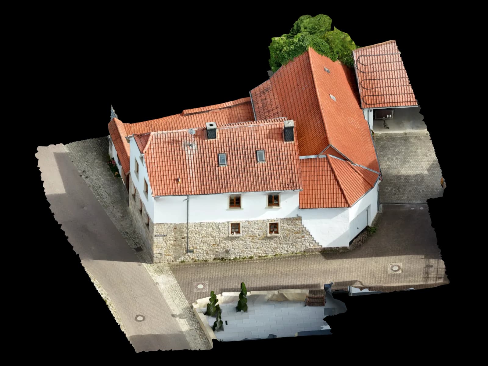
02
Georeferenced orthophoto
A true-to-scale aerial image as GeoTIFF, usable in QGIS and as a planning basis for the densification and new-build areas of the Rhein-Selz villages.
Top view · real model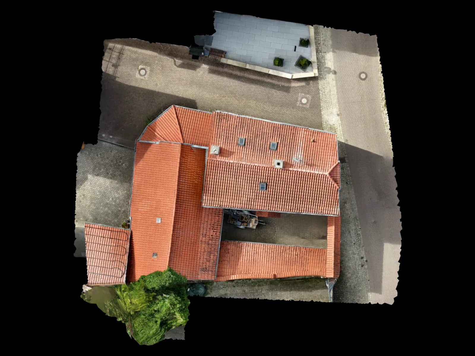
03
Area in m² and volume
Area measurement including all roof structures plus volume and mass calculation – for bulk material, terrace earthworks or erosion zones in the steep sites on the Roter Hang, for example.
File format · deliveryArea in m² and volume04
Point cloud (LAS / LAZ / E57)
A dense point cloud for further processing in CAD and BIM – ideal for the terraced and erosion-prone terrain on the Roter Hang, in the standard format of your surveying and planning software.
File format · deliveryLAS · LAZ · E5705
CAD and BIM export (DXF/DWG, IFC, OBJ/GLB)
Software-ready delivery for AutoCAD, Revit, ArchiCAD and QGIS – in the target format of your workflow.
Edge drawing · real model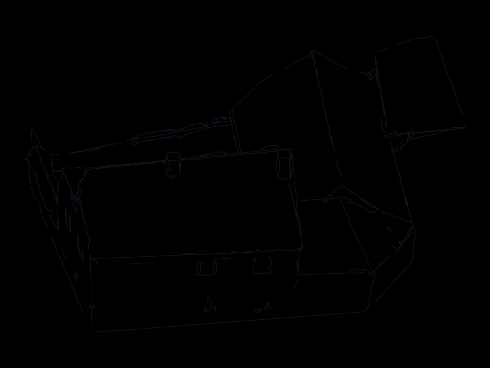
06
Shading analysis for PV
Real roof geometry plus shading for solar installers and PV planners, ready to use in PV*SOL – for the large hall roofs of the Nierstein wineries and cellars, for instance.
Roof planes · real model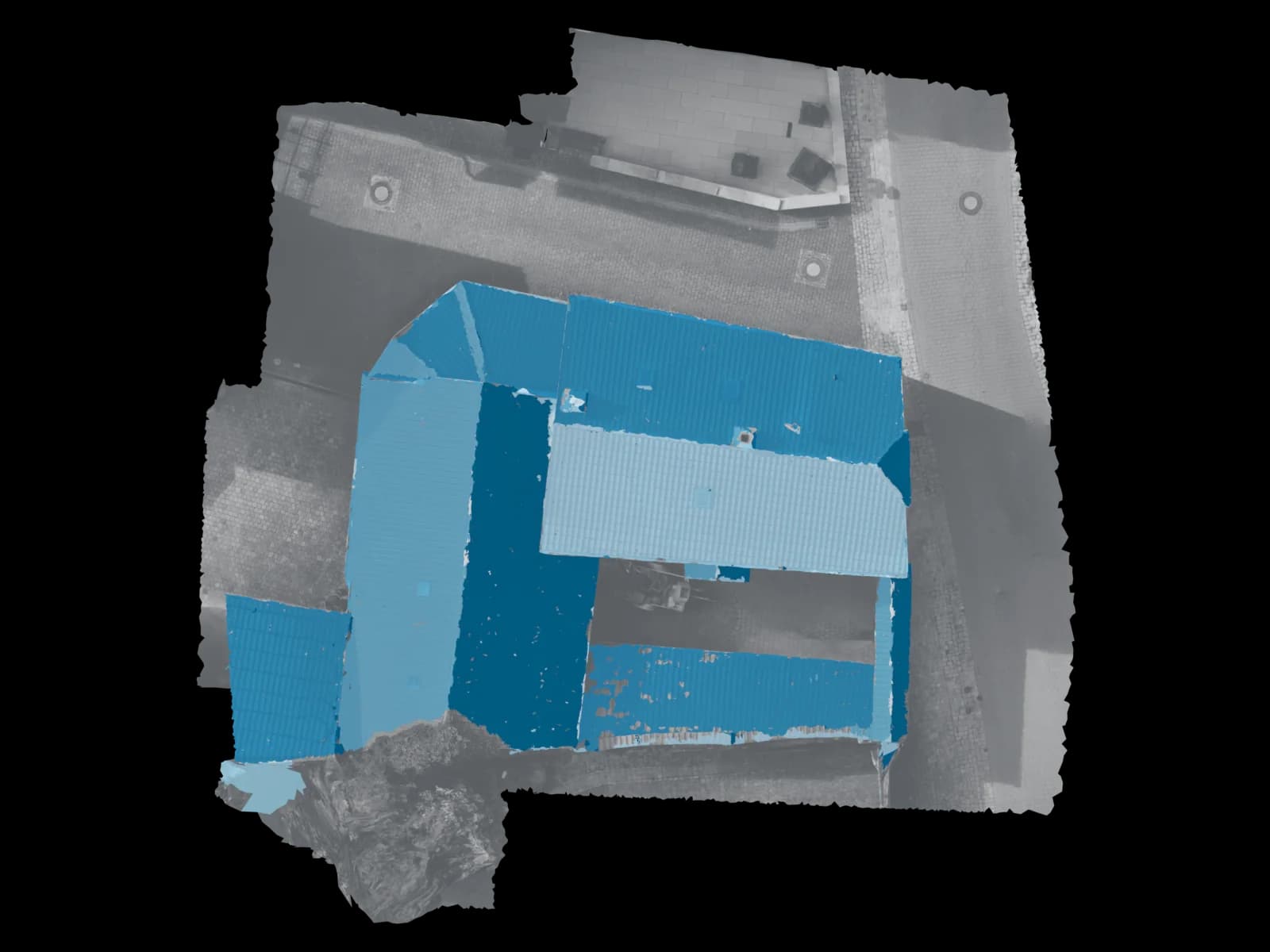
Process
How drone surveying in Nierstein works
Four steps, one owner: from your request to the checked delivery.
Appointment and travel
You describe the site and goal, we check the airspace situation (geo-zones between Finthen and Worms) and come on site from our home base – usually within a few days.
On-site flight
We fly your roof, building or plot ourselves with the drone. Pilot holding the EU remote pilot certificate, one point of contact.
Processing
Photogrammetric reconstruction, georeferencing and manual review into a dimensioned model.
Fast delivery
Model, orthophoto and export in your format – reviewed and usually delivered within 48 hours via a platform link. For sites right in town, often even by quick direct handover.
Request · Nierstein
Calculate drone surveying in Nierstein
Three short steps. The estimate updates as you go; only your fixed quote is binding.
On site in Nierstein
Drone surveying from the town, for the town
Voxelia 3D is based in Nierstein – not in Mainz or Frankfurt with a travel surcharge, but right at the Roter Hang. For jobs in the old town, in Schwabsburg, along the Rhine promenade or across the Rhein-Selz municipality, the distances are remarkably short: we are often at the site within minutes. We arrange an appointment, fly your roof, building or plot with the drone and hand over a measurable data product instead of a photo album.
The region poses its own tasks: Nierstein is the largest wine-growing community in Rheinhessen, with sprawling operating and storage halls belonging to wineries and cellars – ideal surfaces for PV area surveys and roof 3D models. The steep Riesling sites on the Roter Hang – Orbel, Pettenthal, Hipping, Brudersberg and the famous Glöck – have pronounced terrain relief where drone digital terrain models (DTM) and volume or mass calculations are a sensible replacement for ground-based surveying.
The historic building stock in the old town – St. Martin, St. Kilian, Schloss Dalberg-Herding, the watchtower and the baroque noble courts – can also be documented in 3D without contact, with no scaffolding and no roof climbing. For developers and planning offices we deliver georeferenced orthophotos and terrain models from the new-build and densification areas of the Rhein-Selz villages.
Service area around Nierstein
From our home base in Nierstein we reach the Rhein-Selz municipality and the entire surrounding area with a short drive. The immediate neighbouring towns are a few minutes away, and Mainz is around 20 minutes out. We cover the following neighbouring towns from our base on site:
Areas covered in Nierstein
Also in the surrounding area
Why Voxelia
Why drone surveying
Area survey without climbing the roof
We capture roofs and facades from the air without contact – no aerial platform, no scaffolding, no risk. This pays off especially in the steep sites on the Roter Hang, where an aerial platform is simply impossible, and on the large hall roofs of the wineries.
Faster than classic surveying
A single flight captures the entire site completely. Delivery usually within 48 hours instead of weeks – with no multi-day on-site campaigns.
Dimensioned and reviewed
Georeferencing and manual quality control before delivery. You receive measurable data, not unchecked raw images.
Slopes and terrain included
On the Roter Hang in particular, the drone captures slope gradient, terraces and erosion zones where ground-based surveying would be laborious.
Safety & compliance
Why Voxelia 3D in Nierstein
- Home base in Nierstein – short travel, no surcharge from Mainz or Frankfurt
- One contact for flight and model
- Delivery usually within 48 hours
- Person-reviewed, georeferenced data
- Pilot with EU remote pilot certificate / drone licence
Permits and airspace
We are not a broker coordinating a pilot and a separate processing office. Flight and 3D modelling come from one source – one contact, one responsibility, no subcontractor chain. As a Nierstein-based business we know the local airspace situation precisely: the town is free of a control zone but sits between the 1.5 km protective radii of the Mainz-Finthen and Worms airfields. We handle this geo-zone check for every flight location. The pilot holds a valid EU drone licence (EU remote pilot certificate), and we fly in the open category under the EU drone regulation.
Our strength is the dimensioned model: real, measurable 3D data – not mere aerial images – in your software's format, from PV*SOL through AutoCAD and Revit to QGIS. If you are a surveying or planning office and already have your own drone images, we simply take over the processing.
The EU drone regulation (Regulation (EU) 2019/947) applies. We fly in the open category and the pilot holds the EU remote pilot certificate. Nierstein itself is free of a control zone but lies between the 1.5 km protective radii of the Mainz-Finthen and Worms airfields. Before every on-site flight we check the current airspace structure and obtain any required clearances from the competent geo-zone authority (Landesbetrieb Mobilität Rhineland-Palatinate). The flight location, not the company seat, is always decisive.
FAQ
Frequently asked questions about drone surveying in Nierstein
What does drone surveying in Nierstein cost?
Do you come to Nierstein for the flight – or do I have to provide the images myself?
How quickly do I receive the 3D model after the flight?
Do I need a permit for the drone flight on my property?
How accurate and dimensionally true is the survey?
Does the data fit into PV*SOL, AutoCAD, Revit, ArchiCAD or QGIS?
From our Nierstein base
Drone surveying in other locations
Sorted by distance
- Groß-Gerau12 km
- Mainz15 km
- Rüsselsheim am Main15 km
- Raunheim18 km
- Alzey21 km
- Darmstadt23 km
- Ingelheim am Rhein23 km
- Wiesbaden24 km
- Hofheim am Taunus25 km
- Worms26 km
- Neu-Isenburg32 km
- Bingen am Rhein33 km
- Bad Kreuznach34 km
- Eschborn35 km
- Frankfurt am Main36 km
- Offenbach am Main40 km
- Bad Homburg vor der Höhe45 km
- Hanau51 km
- Zürich278 km
49.8697° N · 8.3364° E · Nierstein
Request an on-site flight in Nierstein
Describe your site – we come on site from our home base, fly ourselves and deliver the dimensioned model. Call +49 151 16520282 or send a non-binding enquiry.
Upload & 3D processing
Outside the region or already have your own drone images? Upload them – we build the same verified 3D, CAD and PV data basis from them.
Upload & 3D processing