
On-Site Surveying Rheinhessen · 49.9929° N · 8.2473° E
Drone surveying Mainz.
On-site flight, orthophoto, 3D model and measurements as a checked data basis.
On-site flight from €390 net · live estimate in the form · fixed quote after address and airspace check
- 15 kmfrom our Nierstein base
- 15districts and areas covered
- 12nearby places also covered
- 1contact for flight, clearance and model
Deliverables
What you receive after the flight
Instead of a photo album, you receive a measurable data product: cleanly captured, checked by a person and exported for your planning workflow.
01
Measurable 3D model
A measurable, georeferenced model of a roof, building or plot – the planning basis for the dense new-build quarters at the Zollhafen and the Heiligkreuz district as much as for a single town house.
3D model · real project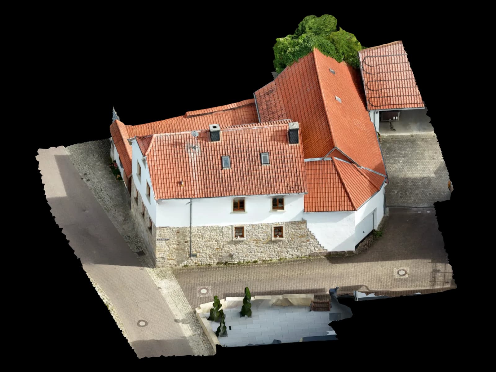
02
Georeferenced orthophoto
A true-to-scale aerial image as GeoTIFF, ready for QGIS, site plans and area assessment – with verifiable accuracy.
Top view · real model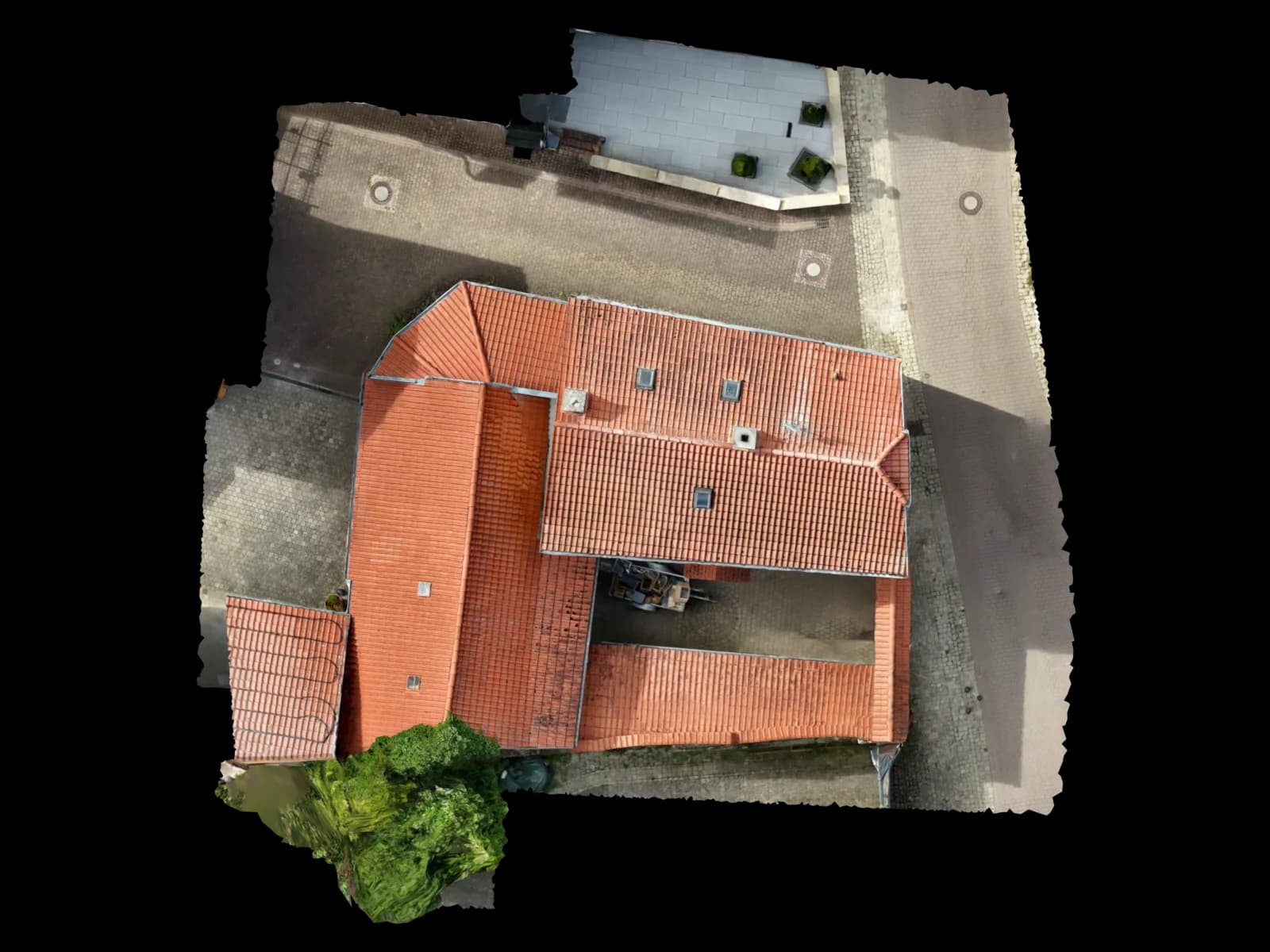
03
Survey and areas in m²
Roof and plot areas measured precisely – no walk-on, no scaffolding, no aerial work platform – ready to use in your quotes.
Screenshot · 3D viewer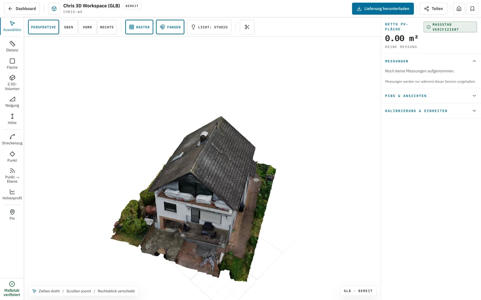
04
Point cloud (LAS/LAZ/E57)
A dense 3D point cloud for as-built capture and volume calculation – for example mass estimates on the riverside conversion sites, importable into common CAD and GIS software.
File format · deliveryLAS · LAZ · E5705
CAD and BIM export
DXF/DWG for AutoCAD, IFC for Revit and ArchiCAD, OBJ/GLB as a 3D mesh – you keep working in your software's format.
Edge drawing · real model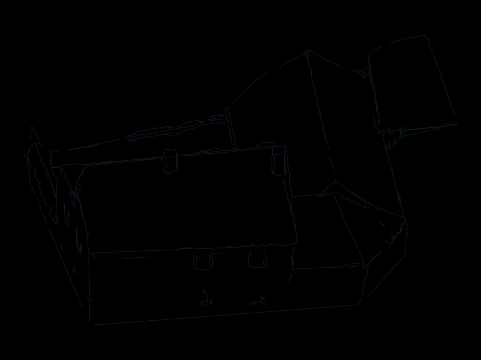
06
Shading analysis for PV
Real roof geometry plus shading for photovoltaic planning on Mainz flat roofs – directly compatible with the PV*SOL workflow.
Roof planes · real model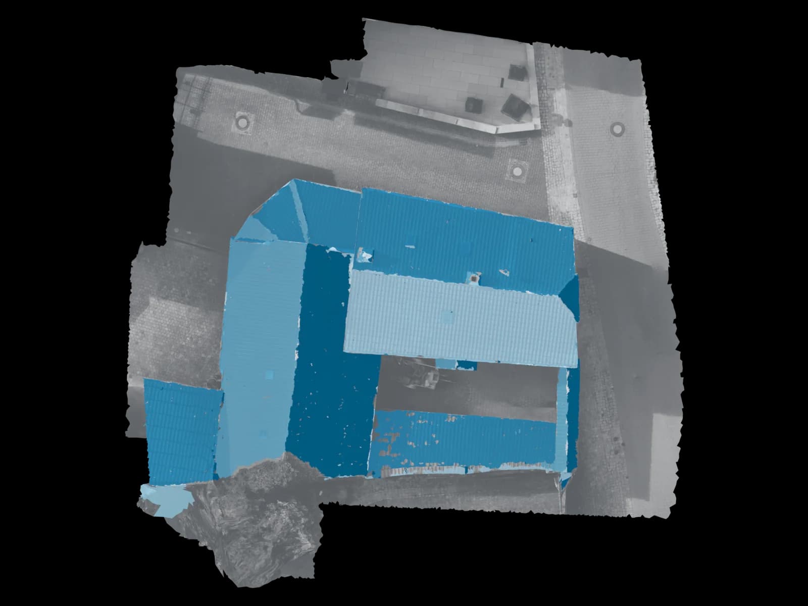
Process
How drone surveying in Mainz works
Four steps, one owner: from your request to the checked delivery.
Appointment and clearance
You tell us about the object and your goal. We check the airspace situation for your address in Mainz, arrange the required clearance or permit and agree a flight date.
On-site flight
We drive over from Nierstein and fly your roof, building or plot with the drone – documented, safe and without anyone having to climb onto the roof.
Processing and modelling
From the imagery we build a measurable 3D model, orthophoto, point cloud and survey via photogrammetry – every result is checked by a person for accuracy.
Delivery within 48 hours
You receive the data in your software's target format – usually within 48 hours, conveniently via platform and viewer link, bundled under one link for multi-object projects in the city centre.
Request · Mainz
Calculate drone surveying in Mainz
Three short steps. The estimate updates as you go; only your fixed quote is binding.
On site in Mainz
Drone surveying with a short drive to Mainz
Our base in Nierstein is only about 15 kilometres upriver from central Mainz – roughly 20 minutes and we are on site with the drone. That proximity makes the difference: we coordinate the appointment, fly your roof, building or plot ourselves and hand over a measurable, georeferenced 3D model. No back-and-forth between a pilot and a separate processing office – the flight and the model come from one source.
Mainz sits in one of the region's most demanding airspaces. Large parts of the city, especially in the north, fall within the control zone of the Wiesbaden-Erbenheim military airfield; add to that the protection radius around the Mainz-Finthen aerodrome (EDFZ) and the university hospital's helicopter pad (Christoph 77). The greater Frankfurt and Wiesbaden areas also shape the airspace structure. In practice, almost every drone flight in Mainz needs clearance or a permit. This is exactly where a locally familiar provider helps: we know the zones, arrange the clearance and handle the paperwork before the drone takes off.
From the dense roofscape in Bretzenheim, Gonsenheim and Hechtsheim, through the large flat roofs of the Hechtsheim commercial park and the Mainz Rhein/Main business park, to new-build and conversion quarters such as the Heiligkreuz district and the Zollhafen – we deliver the geodata that solar installers, architects, developers and property managers actually need for their planning.
Service areas around Mainz
From Nierstein we quickly reach Mainz and the whole of Rheinhessen – the districts on both banks of the Rhine as well as the wine-growing and new-build towns nearby. A selection of the districts and neighbouring towns we fly on site:
Areas covered in Mainz
Also in the surrounding area
Why Voxelia
Why drone surveying instead of a manual walk-through
Faster to a planning basis
Instead of days of walk-throughs with scaffolding, a single drone flight captures the full geometry in one pass – with the model usually delivered within 48 hours.
Surveying without climbing the roof
Tightly stacked dormers and hard-to-reach façades in the dense roofscape of Bretzenheim and Gonsenheim are captured from the air – no aerial platform, no scaffolding, no one having to step onto the roof.
Complete, verifiable data
You get a measurable data product, not a photo album – with dimensions, areas and volumes in formats your software reads directly.
Safety & compliance
Why Voxelia 3D in Mainz
- Short drive from Nierstein – around 20 minutes to Mainz
- One contact for flight, clearance and model
- Delivery usually within 48 hours
- Person-checked, georeferenced data
- Pilot's EU remote pilot certificate, familiar with Mainz airspace
Permits and airspace in Mainz
Voxelia 3D is based in Nierstein, about 15 kilometres upriver from Mainz – the shortest drive to the state capital of all our locations. You have one contact for flight clearance, the survey flight and modelling, instead of coordinating between a pilot and a processing office. Our pilot holds a valid EU remote pilot certificate (drone licence) and knows the Mainz airspace around Erbenheim, Mainz-Finthen and the hospital helicopter pad from practice.
Every model is checked by a person for accuracy before it reaches you. We deliver genuine, measurable 3D models and geodata – not just aerial photos – with export for PV*SOL, AutoCAD, Revit, ArchiCAD and QGIS.
In Mainz almost every drone flight needs clearance or a permit: the north lies within the Wiesbaden-Erbenheim military control zone, and there are protection radii around the Mainz-Finthen aerodrome (EDFZ) and the university hospital helicopter pad (Christoph 77); the greater Frankfurt and Wiesbaden areas also shape the airspace structure. The EU drone regulation applies. For geographical zones and ascent permits in Rhineland-Palatinate the Landesbetrieb Mobilität (LBM) is responsible; for permit-bound operations in the 'specific' category, responsibility passed to the Luftfahrt-Bundesamt (LBA) on 1 April 2026. Flights into control zones additionally require clearance from DFS or the military. Our pilot holds a valid EU remote pilot certificate. We check the zone for your address and handle the necessary clearances and permits – one contact for paperwork, flight and model.
FAQ
Frequently asked questions about drone surveying in Mainz
What does a drone survey in Mainz cost?
Do you come to Mainz for the flight – or do I have to supply the images myself?
Do I need a permit for a drone flight in Mainz – and do you take care of it?
How accurate and measurable is the drone survey?
Which data and formats do I receive?
How quickly do I get the model after the flight?
From our Nierstein base
Drone surveying in other locations
Sorted by distance
- NiersteinBase
- Groß-Gerau12 km
- Rüsselsheim am Main15 km
- Raunheim18 km
- Alzey21 km
- Darmstadt23 km
- Ingelheim am Rhein23 km
- Wiesbaden24 km
- Hofheim am Taunus25 km
- Worms26 km
- Neu-Isenburg32 km
- Bingen am Rhein33 km
- Bad Kreuznach34 km
- Eschborn35 km
- Frankfurt am Main36 km
- Offenbach am Main40 km
- Bad Homburg vor der Höhe45 km
- Hanau51 km
- Zürich278 km
49.9929° N · 8.2473° E · Mainz
Request an on-site flight in Mainz
Tell us briefly about your object – we check the airspace for your address, coordinate the flight and clearance and deliver the measurable 3D model usually within 48 hours. Call us on +49 151 16520282 or request a no-obligation quote. Voxelia 3D, Nierstein, Rheinhessen.
Upload & 3D processing
Outside the region or already have your own drone images? Upload them – we build the same verified 3D, CAD and PV data basis from them.
Upload & 3D processing