
Drone Surveying Wiesbaden · 50.0782° N · 8.2398° E
Drone surveying Wiesbaden.
On-site flight, orthophoto, 3D model and measurements as a checked data basis.
On-site flight from €390 net · live estimate in the form · fixed quote after address and airspace check
- 24 kmfrom our Nierstein base
- 16districts and areas covered
- 12nearby places also covered
- 1contact for flight, clearance and model
Deliverables
What you receive after the flight
Instead of a photo album, you receive a measurable data product: cleanly captured, checked by a person and exported for your planning workflow.
01
Measurable 3D model
A measurable, georeferenced model of the building, roof or plot – the basis for heritage-conscious as-built surveys of Wiesbaden's historicist stock as much as for new builds and documentation.
3D model · real project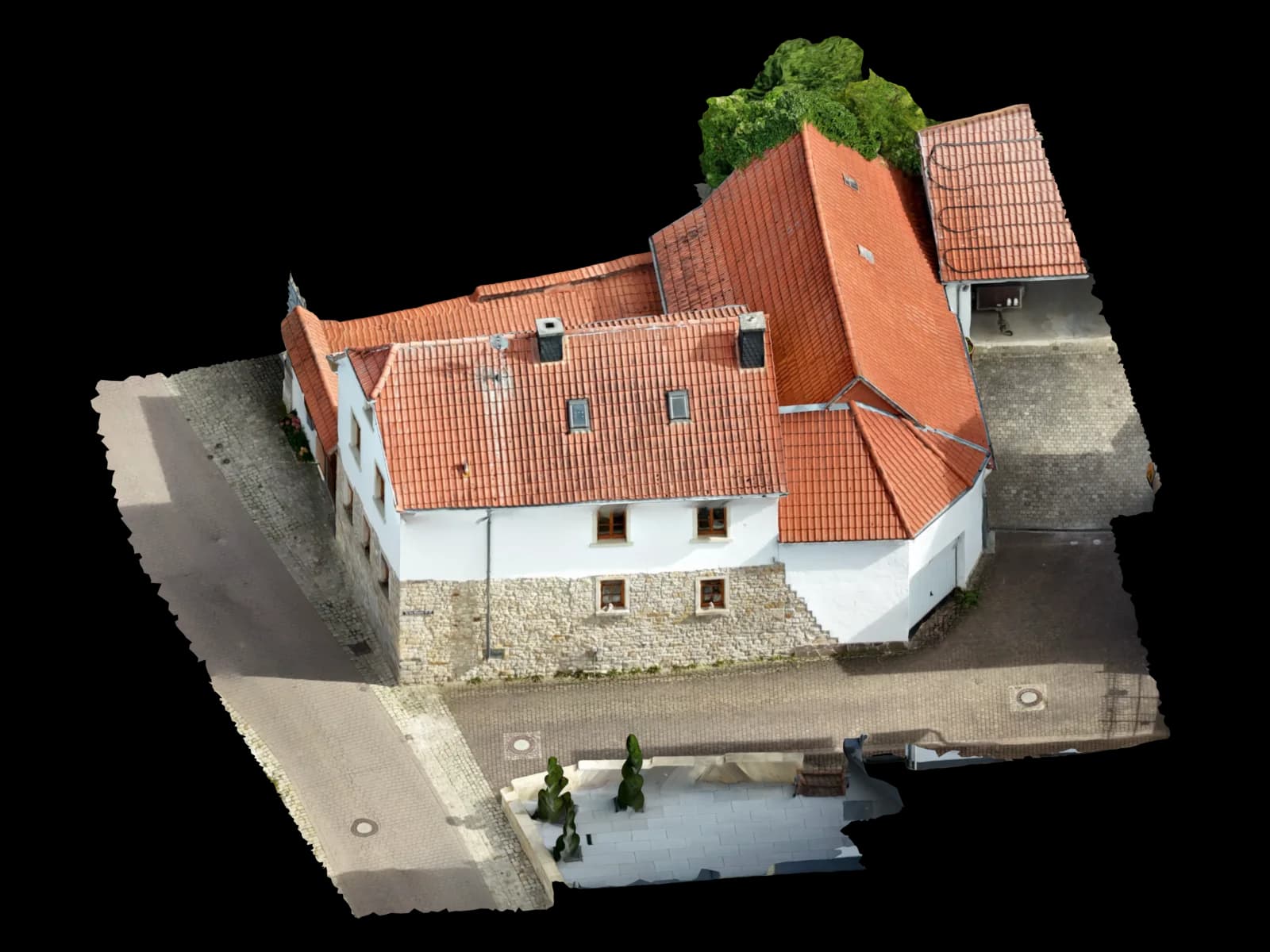
02
Georeferenced orthophoto
A true-to-scale aerial image as GeoTIFF in which you measure distances and areas directly – ideal for as-built plans of the dense Kurviertel fabric and for plot analysis.
Top view · real model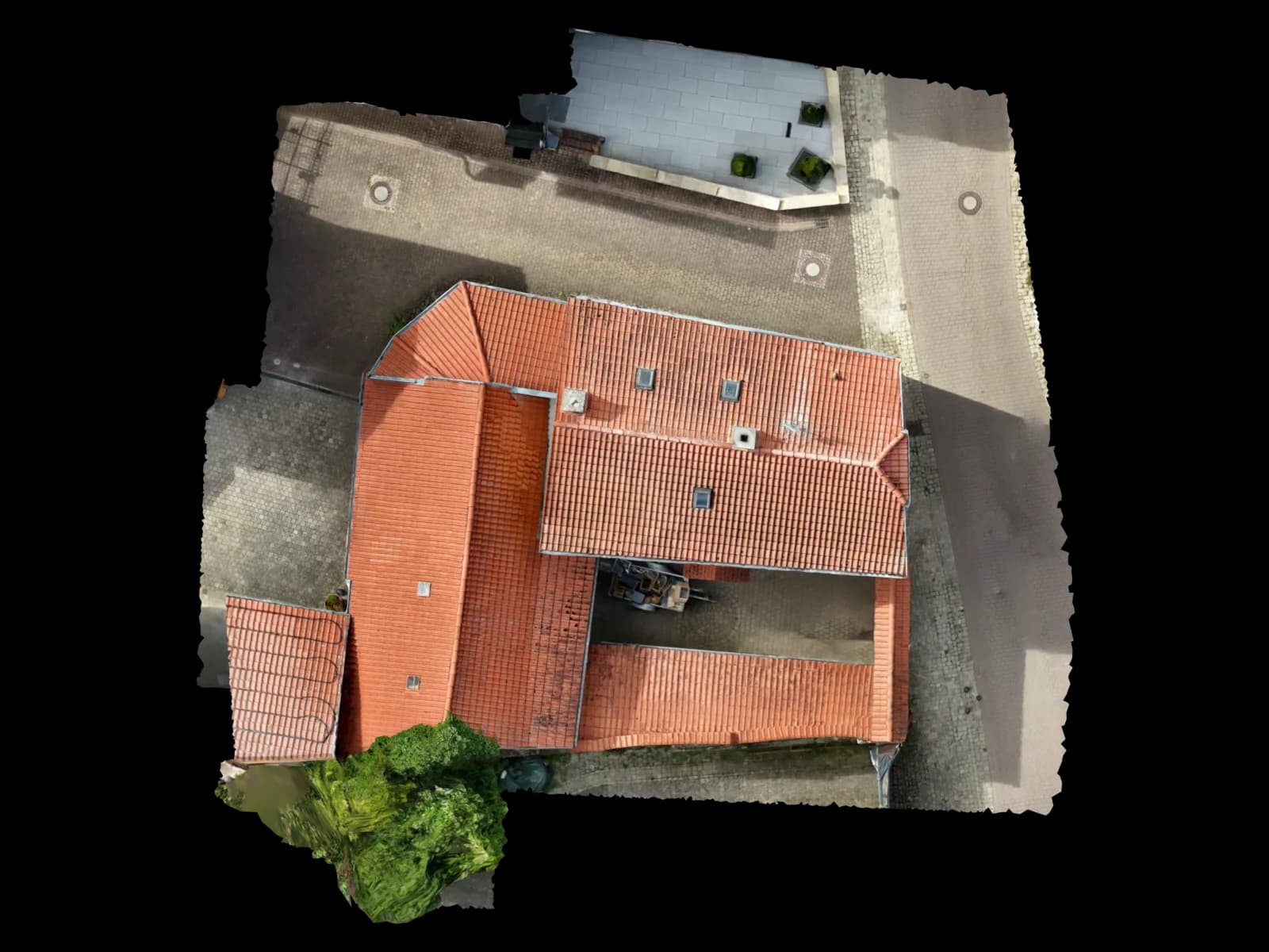
03
Area in m² and volume
Area calculation for roofs and plots plus volume and mass calculation for earthworks, bulk material and construction progress on the commercial and building sites in Nordenstadt and Erbenheim.
File format · deliveryArea in m² and volume04
Point cloud (LAS/LAZ/E57)
A dense, georeferenced point cloud of the intricate villa roofs in Sonnenberg or the wide hall roofs of the Kalle-Albert industrial park – in the standard format of your surveying and planning software.
File format · deliveryLAS · LAZ · E5705
CAD and BIM export (DXF/DWG, IFC)
Delivered in the target format of your software – DXF/DWG for AutoCAD, IFC for Revit and ArchiCAD, OBJ/GLB for 3D workflows.
Edge drawing · real model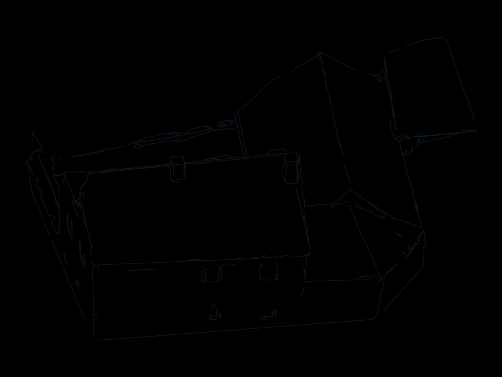
06
Shading analysis for PV
Real roof geometry including shading for photovoltaic planning – ready to use in the PV*SOL workflow for solar installers and PV planners.
Roof planes · real model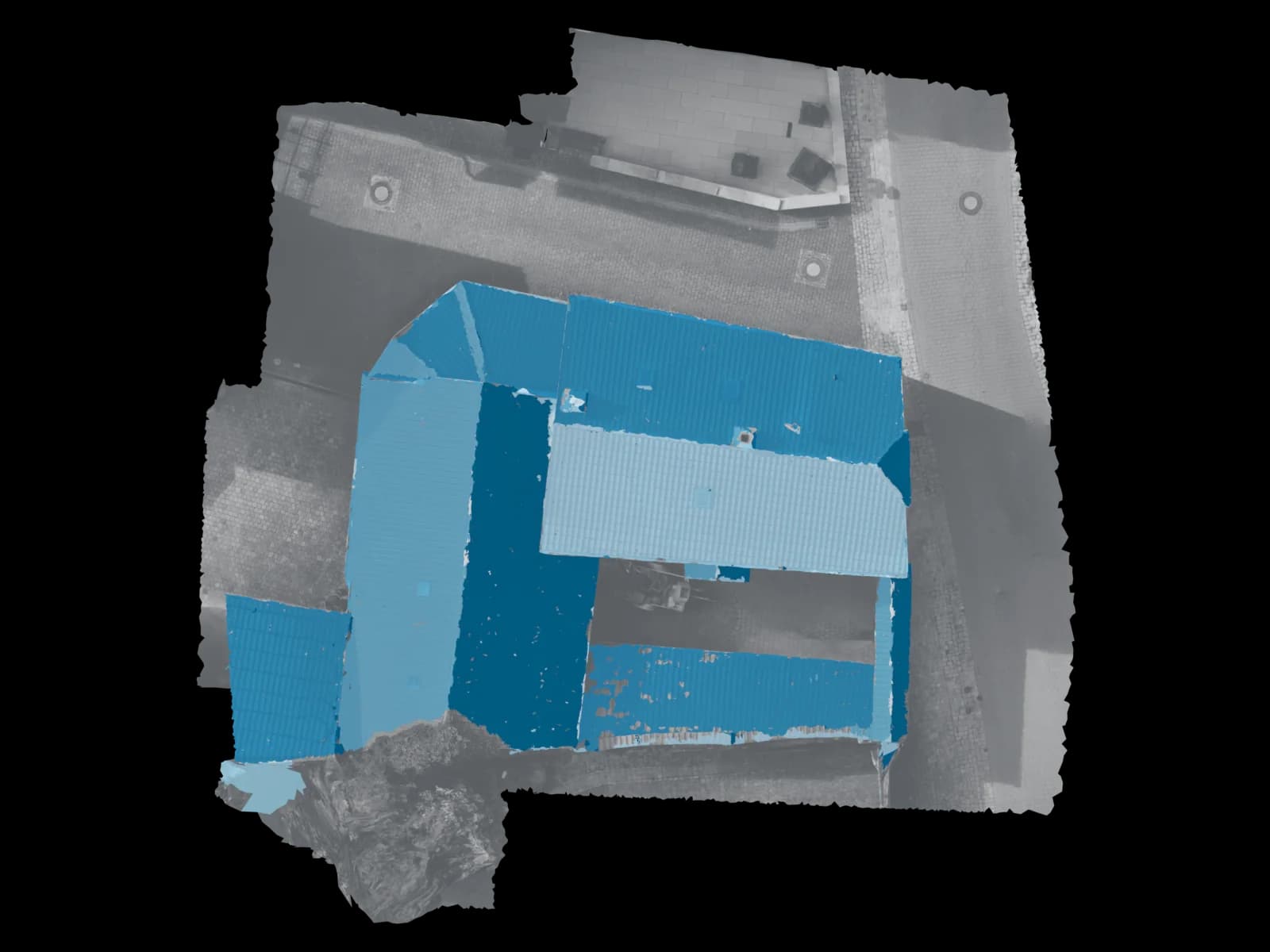
Process
How drone surveying in Wiesbaden works
Four steps, one owner: from your request to the checked delivery.
Request and clearance
You describe the object and location. We check the airspace situation – the Erbenheim control zone and, in the south, the Frankfurt airport environs – and handle the dual registration with the public-order authority and the air traffic office, with the required lead time.
On-site flight
Once clearance is granted, our pilot comes to Wiesbaden and flies the object with the right image overlap – safely, with no roof access and no scaffolding or aerial lift.
Processing and quality check
From the imagery we build the georeferenced model, and a person verifies accuracy and completeness before anything leaves the studio.
Delivery within 48 hours
You receive your data in the requested format – usually within 48 hours of the flight, provided via a viewer and download link. The clearance lead time happens before this date.
Request · Wiesbaden
Calculate drone surveying in Wiesbaden
Three short steps. The estimate updates as you go; only your fixed quote is binding.
On site in Wiesbaden
Drone surveying in Wiesbaden – flown on site, checked on delivery
Wiesbaden is one of the most demanding cities in Germany for drone flights. Almost the entire urban area sits within the Class D airspace of the US Army Airfield Erbenheim – practically every flight must be coordinated not only with the city's public-order authority but also with the airfield's air traffic office, typically with several business days' lead time. That is exactly where we come in: we build in that lead time from the start, handle the dual registration and fly as soon as clearance is granted. What you receive is a checked, measurable data product – not a photo album.
From historicist buildings in the Kurviertel and the Wilhelminian villas of Sonnenberg and Bierstadt to the large hall roofs in the Kalle-Albert industrial park in Amöneburg or the commercial zones in Nordenstadt: we capture roofs, façades, plots and construction sites from the air and turn them into measurable 3D models, orthophotos and point clouds. We are based in Nierstein in Rheinhessen – a short drive across the Rhine to Wiesbaden, which keeps scheduling flexible and travel times short.
With around 10,000 listed objects in its heritage register, Wiesbaden is known as the city of historicism. Accurate as-built surveys for heritage-conscious renovation, roof and façade measurement without scaffolding or aerial lifts, shading and layout analysis for PV on existing roofs – these are the tasks architects, property managers, site supervisors and solar installers bring to us here. Anyone who already has their own imagery simply uploads it and receives the same checked result.
Service area around Wiesbaden
From our base in Nierstein we reach Wiesbaden and the wider Rhine-Main region with a short drive across the Rhine. We fly in every district – from Mitte, Biebrich and Schierstein through Sonnenberg, Bierstadt and Erbenheim to the AKK districts of Kostheim, Kastel and Amöneburg, as well as the suburbs of Nordenstadt, Delkenheim and Frauenstein. We also serve the neighbouring towns in the Rheingau and along the Main on site.
Areas covered in Wiesbaden
Also in the surrounding area
Why Voxelia
Why drone surveying instead of conventional measurement
Surveying without scaffolding or lifts
Wiesbaden's tall Wilhelminian villas and historicist old-building stock would otherwise demand elaborate scaffold safety. We capture roofs and façades from the air – with no roof access and no fall risk.
Faster than conventional surveying
A single flight captures an object's complete geometry. Instead of days of manual measurement, you have the checked model usually within 48 hours of the flight.
Complete, measurable data
You receive not an aerial photo but a measurable model in which every area, height and edge can be measured afterwards – in your own software.
One contact for flight and model
Flight, clearance and processing come from one source – no subcontractor ping-pong between pilot and analyst, which is a real advantage with the dual Erbenheim coordination.
Safety & compliance
Why Voxelia 3D
- Routine with the Erbenheim control zone and the Frankfurt environs in the south
- Dual registration with the public-order authority and air traffic office, lead time included
- One contact for flight, clearance and processing
- Fast delivery – usually within 48 hours of the flight
- Person-checked, georeferenced and measurable data
Clearance and legal framework in Wiesbaden
Voxelia 3D is based in Nierstein in Rheinhessen – a short drive across the Rhine to Wiesbaden. More important than the distance is the routine with the particular airspace situation: we know the control zone of the US Army Airfield Erbenheim, the adjacent Frankfurt environs in the south and the process with the air traffic office, build in the required lead time and handle the dual registration with the city and the airfield. Flight and modelling stay in one hand, so you have exactly one contact for the entire project.
Our pilot holds the EU certificate of competency (drone licence) and flies in accordance with the applicable EU drone rules. Every dataset is checked by a person for accuracy and completeness before delivery – and exported in the target format of your software, from PV*SOL through AutoCAD and Revit to ArchiCAD and QGIS.
Drone flights are governed by the EU drone regulation; the pilot is registered as a UAS operator and holds a valid EU certificate of competency. The responsible state aviation authority for the independent city of Wiesbaden is the Regierungspräsidium Darmstadt. The particularity in Wiesbaden: almost the entire urban area lies within the Class D airspace of the US Army Airfield Erbenheim, and in the south it borders the environs of Frankfurt airport. Clearance here must be coordinated with the public-order authority and the airfield – the air traffic office usually expects several business days' lead time. We handle this dual registration and check the geo-zones before every flight via the official sources.
FAQ
Frequently asked questions about drone surveying in Wiesbaden
What does drone surveying in Wiesbaden cost?
Do you come to Wiesbaden to fly – or do I have to supply the images myself?
Do I need a permit for the drone flight in Wiesbaden?
How accurate and measurable is the survey?
Which data and formats do I receive after the flight?
Is drone surveying suitable for my PV planning in Wiesbaden?
From our Nierstein base
Drone surveying in other locations
Sorted by distance
- NiersteinBase
- Groß-Gerau12 km
- Mainz15 km
- Rüsselsheim am Main15 km
- Raunheim18 km
- Alzey21 km
- Darmstadt23 km
- Ingelheim am Rhein23 km
- Hofheim am Taunus25 km
- Worms26 km
- Neu-Isenburg32 km
- Bingen am Rhein33 km
- Bad Kreuznach34 km
- Eschborn35 km
- Frankfurt am Main36 km
- Offenbach am Main40 km
- Bad Homburg vor der Höhe45 km
- Hanau51 km
- Zürich278 km
50.0782° N · 8.2398° E · Wiesbaden
Request drone surveying in Wiesbaden
Tell us about your object – we check the airspace situation, handle the dual clearance with lead time and fly on site. Checked model usually within 48 hours of the flight. Call +49 151 16520282 or request a no-obligation quote.
Upload & 3D processing
Outside the region or already have your own drone images? Upload them – we build the same verified 3D, CAD and PV data basis from them.
Upload & 3D processing