
Why flat roof drainage is a 3D topic
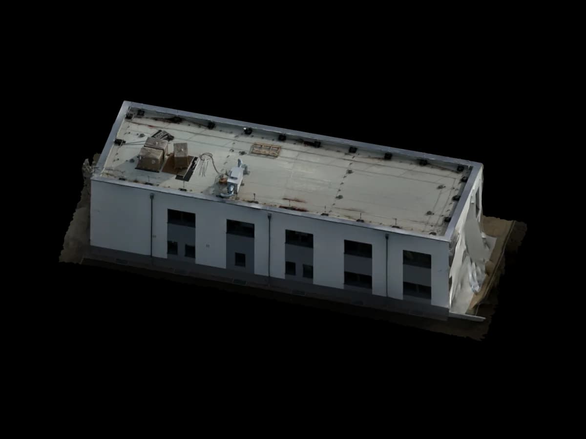
Flat roof drainage depends on small height differences, low points, parapets, roof penetrations, PV substructures and existing refurbishment layers. A single photo or old 2D plan rarely explains that geometry reliably.
Voxelia processes supplied imagery into measurable 3D models, orthophotos, height context, marked risk areas and CAD or viewer deliverables. Drain sizing and compliance remain with qualified specialists.
What the 3D model makes visible
A useful model turns the roof into readable terrain: high edges, low zones, flow directions, drains, upstands, transitions, parapets and adjacent components can be reviewed together.
The strongest delivery combines orthophoto and 3D height context. The orthophoto shows drains, seams and equipment; the model adds spatial logic for early slope checks and coordination.
Review matrix for roofers, PV teams and planners
| Review | Model value | Input data | Limit |
|---|---|---|---|
| Slope direction and low points | Height model and sections show likely flow paths. | 3D model, orthophoto, reference dimensions | Small height differences require strong references. |
| Drains and emergency overflows | Locations and potential obstructions become visible. | Orthophoto, detail photos, CAD marks | Sizing remains specialist design. |
| Flat roof PV layout | Module fields and service paths can be checked against drainage zones. | 3D roof model, CAD/DXF, roof obstructions | Yield, structural and fire safety checks are separate. |
| Refurbishment planning | Existing heights and problem zones structure the takeoff. | Point cloud, sections, orthophoto | Moisture, layers and waterproofing need expert inspection. |
Workflow: from imagery to drainage planning base
Define the question
Collect drains, parapets, low points, PV zones, service paths and known ponding areas as review targets.
Check imagery and references
We review sharpness, overlap, coverage, metadata, reference dimensions and whether drainage areas are visible.
Build model and orthophoto
Suitable imagery becomes mesh, point cloud, orthophoto and height context.
Mark slope and risk zones
Low points, flow paths, upstands, obstructions and ponding risks are marked in the delivery.
Export the delivery
Viewer, screenshots, DXF/DWG, point cloud, orthophoto or BIM-oriented data are prepared for the next workflow.
Standards, heavy rain and responsibility
Drainage design depends on standards and local rain data. DIN Media lists DIN EN 12056-3 for roof drainage. In Germany, DIN 1986-100 is also used in practice for site drainage and emergency drainage context.
For design rainfall, KOSTRA-DWD 2020 is the official German Weather Service basis for regional heavy rainfall values. The 3D model supports the geometry; specialists remain responsible for sizing and compliance.
Useful deliverables for refurbishment, PV and as-built review
Roofers often need CAD-ready edges, drains, obstructions and marked problem areas. PV teams also need drainage zones, service paths and module fields in one planning context.
Voxelia can prepare orthophotos, point clouds, meshes, DXF/DWG, BIM-oriented files or a web viewer, depending on the downstream workflow.