
Where a textured 3D mesh helps in restoration and heritage work
Restoration projects rarely need a pretty 3D view alone. The useful question is whether visible conditions become spatially traceable: cracks, plaster loss, stone joints, dormers, ornaments, interfaces, roof edges and facade details must be found again later and connected to planning, scope or review.
A textured 3D mesh is useful because it reconstructs the surface from overlapping photos and places image information onto the geometry. It does not replace structural assessment or formal surveying, but it can become a dependable visual and spatial working base for planners, restorers, roofers, architects and owners.
Voxelia is not positioned as the drone-flight vendor here. The value is in processing: supplied aerial images, building photos, detail shots or mixed image sets are reviewed, reconstructed, cleaned and handed over so the next step is not stuck in loose photo folders.
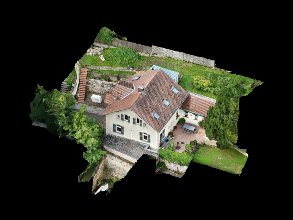
What imagery is needed for a usable mesh
Quality starts before software. Photogrammetry needs overlapping, sharp images that show the same components from multiple viewpoints. COLMAP describes image-based reconstruction as estimating camera poses and sparse structure before dense reconstruction. If too few shared features exist, no tool can create a stable surface.
For restoration and heritage work, detail series matter. Facade fields need different viewpoints than roof interfaces, cornices, figures, window reveals or natural stone areas. Good datasets combine overview images for orientation with close details for surface evidence and texture quality.
Original files are more valuable than pre-compressed, cropped or heavily filtered images. EXIF data, consistent focal lengths and unchanged image geometry help calibration. Mixed camera sources can work, but they need separate review and careful merging.
From photos to a usable restoration model
A textured mesh is not planning-ready just because it looks good. The useful checkpoints are dataset review, reconstruction, cleanup, scale context, semantic interpretation and export into suitable delivery formats.
Review imagery and define output
We clarify whether the deliverable is intended for damage mapping, restoration review, CAD basis, BIM coordination, orthophoto or web viewer.
Check reconstruction and texture quality
Alignment, dense cloud, mesh surface and texture are checked for gaps, ghost surfaces, blurred areas and implausible deformation.
Establish scale and context
Depending on the dataset, reference dimensions, existing drawings, control points or known component sizes are used to make the model useful in the project context.
Prepare planning delivery
The mesh can feed views, orthophotos, section bases, CAD linework, viewer files or BIM-oriented reference models.
Useful deliverables by project phase
The right export depends on the next decision. Restorers often need high-resolution surface views, while architecture and specialist planning need organized sections, areas, reference planes or CAD layers.
| Project phase | Mesh value | Review | Useful delivery |
|---|---|---|---|
| Initial survey | Understand condition spatially and organize photos | Overlap, sharpness, gaps, scale context | Viewer, mesh, annotated screenshots |
| Damage mapping | Locate cracks, plaster loss, discoloration or interfaces in the model | Texture sharpness, detail coverage, clear viewpoint | Orthophoto, detail views, markups, BCF-oriented review |
| Planning | Use existing geometry as reference for sections, views and component edges | Scale, axes, planes, local deformation | DXF/DWG, point cloud, BIM reference, PDF extracts |
| Execution and handover | Compare before/after states and document decisions | Version state, viewpoints, open review points | Web viewer, model package, photo documentation, plan appendix |
Limits: what a textured mesh does not automatically provide
A photo-based mesh captures visible surfaces. Hidden construction, material properties, structural capacity or moisture in a component do not appear automatically. Reflective, transparent, repetitive or heavily shadowed surfaces can also make reconstruction harder.
For legal, structural or formal survey decisions, the responsible planners, experts or surveyors remain necessary. The mesh is a documentation and planning base, not a substitute for their review.
Visual plausibility and measurement use are different. A model can look convincing in texture and still contain local geometry errors. Voxelia therefore checks delivery formats against the intended use instead of calling every mesh CAD or BIM ready.
How Voxelia makes the model useful for planning and coordination
Voxelia processes supplied building, roof, facade and detail images into a model state that works downstream. That includes clear file structure, traceable versions, suitable export formats and useful links between mesh, orthophoto, CAD basis or viewer.
For architecture and surveying, the focus may be point clouds, sections, CAD layers or BIM references. For roofers, facade contractors and restoration teams, detail views, damage marks, orthophotos and simple viewer delivery are often more useful.
The best start is not a generic format promise, but a short review of the existing imagery: what can be reconstructed reliably, which areas are weak and which delivery approach will save time in the next step?