
On-site service · Canton of Jura · 50 municipalities
Drone surveying Canton of Jura.
In the canton of Jura distances are short, the journey there is not: Vicques is 80 km from our base, Delémont 85 km, Porrentruy 105 km, and Saignelégier in the Franches-Montagnes, at 982 m above sea level, 113 km. You receive quote and delivery in German or English. We fly your roof, building or plot ourselves and deliver orthophoto, 3D model and measurements.
On-site flight from CHF 480 net incl. travel to Delsberg · roof with 3D model CHF 530–740 · fixed price by quote
- Centre without a drone zone
- Control zone, free up to 120 m
- Clearance needed
- Control zone (CTR)
- Airfield zone
Canton of Jura · 858 km² · boundaries: swisstopo · drone zones: FOCA · as of 15 November 2026
- 86 kmto Delsberg
- CHF 190Travel to Delsberg (included up to 40 km)
- CHF 480On-site flight from, net
- 9/10Town centres where we fly without clearance
Price calculator · Canton of Jura
What does your flight in the canton of Jura cost?
Draw the area on the map – airspace, elevation and roof faces come from federal geodata. Your indicative quote builds on the right, item by item.
Airspace in the canton of Jura
Where we fly without clearance. And who grants it otherwise.
The Jura has quiet airspace: nine of the ten largest municipalities lie in no drone zone, including Delémont and Saignelégier. The only airfield zone belongs to the Bressaucourt airfield and covers Porrentruy; the Aérodrome du Jura asks for 10 days’ notice. In the Franches-Montagnes the Étang de la Gruère and the raised bog of La Chaux-des-Breuleux are protected, and the environment office asks for 14 days.
| Zone | Rule for drones | Authority | Lead time |
|---|---|---|---|
| Control zone Les Eplatures | above 250 g prohibited only from 120 m above ground – survey flights below need no clearance | Skyguide | none below 120 m |
| Airfield zone Bressaucourt (LSZQ) | above 250 g prohibited, exemption on request | Aérodrome du Jura | 10 days |
| 2 nature protection zones | prohibited for all drones, e.g. Étang de la Gruère, Réserve naturelle tourbière de La Chaux des Breuleux | Republik und Kanton Jura | 14 days |
| 5 protected sites | prohibited for all drones, e.g. Gefängnis Moutier, Prison de Delémont, Unterwerk Bassecourt | Service juridique · Swissgrid AG | 5–10 days |
Municipalities in the canton of Jura
Travel, elevation and airspace, place by place.
The 10 municipalities with the largest roof solar potential in the canton. The number is on the map above; click a name to open the calculator there.
| No. | Municipality | Distance | Travel | Elevation | Roof potential | Drone zone at the centre |
|---|---|---|---|---|---|---|
| 01 | Delémont | 85 km | CHF 190 | 413 m | 107 GWh | none |
| 02 | Haute-Sorne (Bassecourt) | 93 km | CHF 190 | 477 m | 80.1 GWh | none |
| 03 | Porrentruy | 105 km | CHF 190 | 424 m | 62.7 GWh | LSZQ Bressaucourt · clearance, 10 days ahead |
| 04 | Val Terbi (Vicques) | 80 km | CHF 90 | 451 m | 40.6 GWh | none |
| 05 | Courgenay | 102 km | CHF 190 | 490 m | 39.2 GWh | none |
| 06 | Saignelégier | 113 km | CHF 190 | 982 m | 34.6 GWh | none |
| 07 | Courrendlin | 83 km | CHF 190 | 435 m | 33.4 GWh | none |
| 08 | Courroux | 83 km | CHF 190 | 422 m | 33.4 GWh | none |
| 09 | Alle | 101 km | CHF 190 | 448 m | 30 GWh | none |
| 10 | Boncourt | 110 km | CHF 190 | 369 m | 27.7 GWh | none |
Prices in the canton of Jura
Three jobs, three estimates.
Travel is included up to 40 km from Oberengstringen; beyond that a flat fee applies: to Val Terbi (Vicques) (80 km) CHF 90, to Saignelégier (113 km) CHF 190.
| Job | Scope | Estimate to Delsberg |
|---|---|---|
| Roof of a detached house for solar planning | Orthophoto and 3D model, checked dimensions, up to 500 m² | CHF 530–740 |
| Building with facades for an as-built survey | Orthophoto, 3D model and point cloud, checked dimensions, 1,200 m² | CHF 720–1,150 |
| Plot for site plan and terrain | Orthophoto and 3D model, checked dimensions, 5,000 m² | CHF 800–1,380 |
Roofs in the canton of Jura
1,000 GWh of solar power sit on the roofs.
That is how much electricity the roofs of the 50 municipalities in the canton of Jura could deliver per year according to the Swiss Federal Office of Energy; the facades would add 304 GWh. Delémont has the largest potential with 107 GWh.
That is a model calculation. For a system in Delémont or Boncourt, what counts is the roof as it stands today – the flight measures that.
- Roof solar potential
- 1,000 GWh/yr
- facades in addition
- 304 GWh/yr
- Municipalities
- 50
- Area
- 858 km²
- Centres from … to
- 369–982 m a.s.l.
Process
From click to checked delivery.
Mark your plot
Draw the area in the calculator – area, elevation, drone zone and indicative quote appear at once.
Fixed quote
We check address and airspace and send you a binding quote by email.
Flight on site
We drive from Oberengstringen to Delsberg (86 km as the crow flies), obtain any clearance and fly your site.
Checked delivery
Orthophoto, 3D model, measurements or CAD – checked by a person, in your software’s format.
Deliverables
What reaches you after the flight.
01
Measurable 3D model
Georeferenced, checked by a person and ready as a browser link or OBJ/GLB.
3D model · real project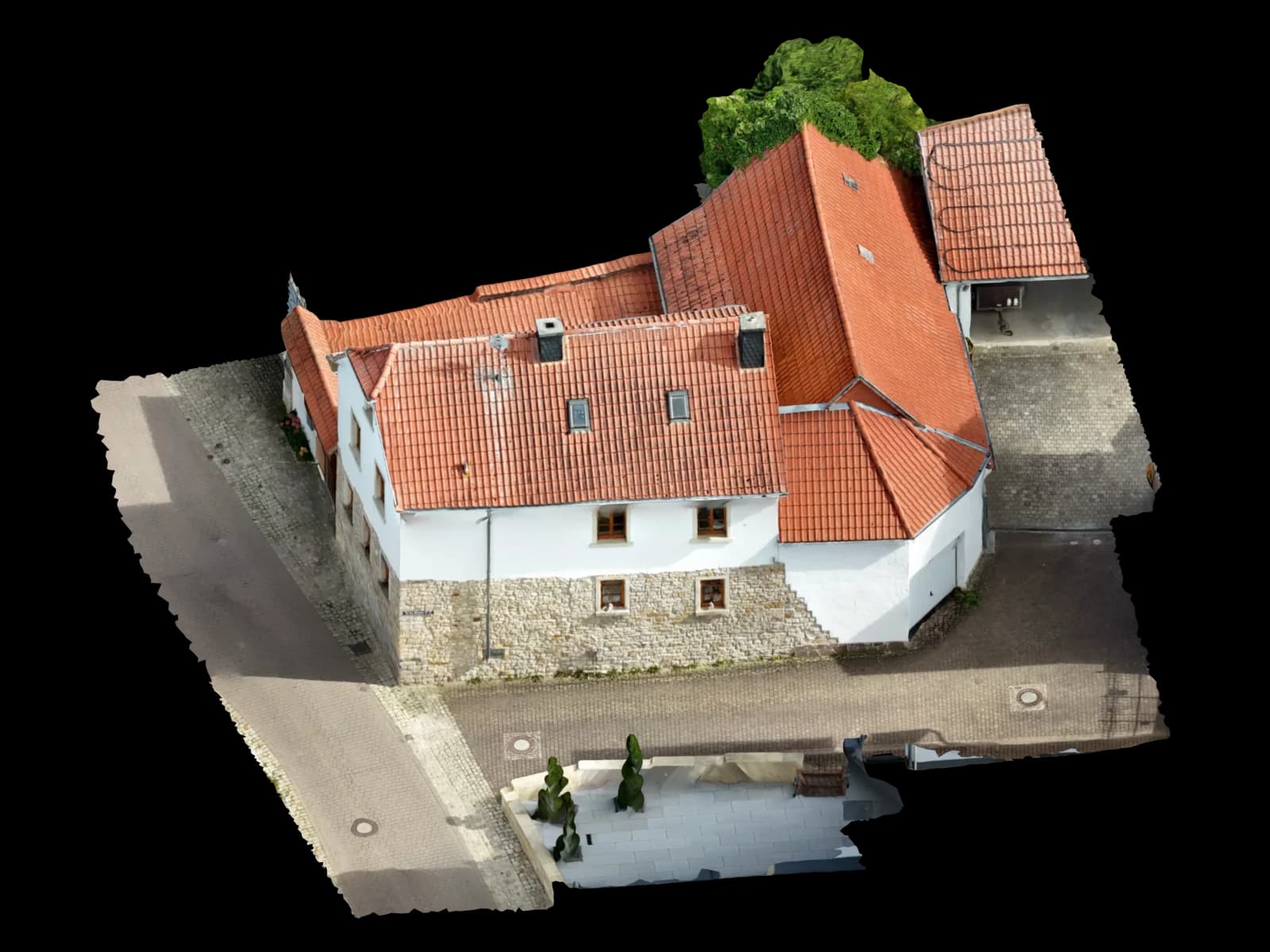
02
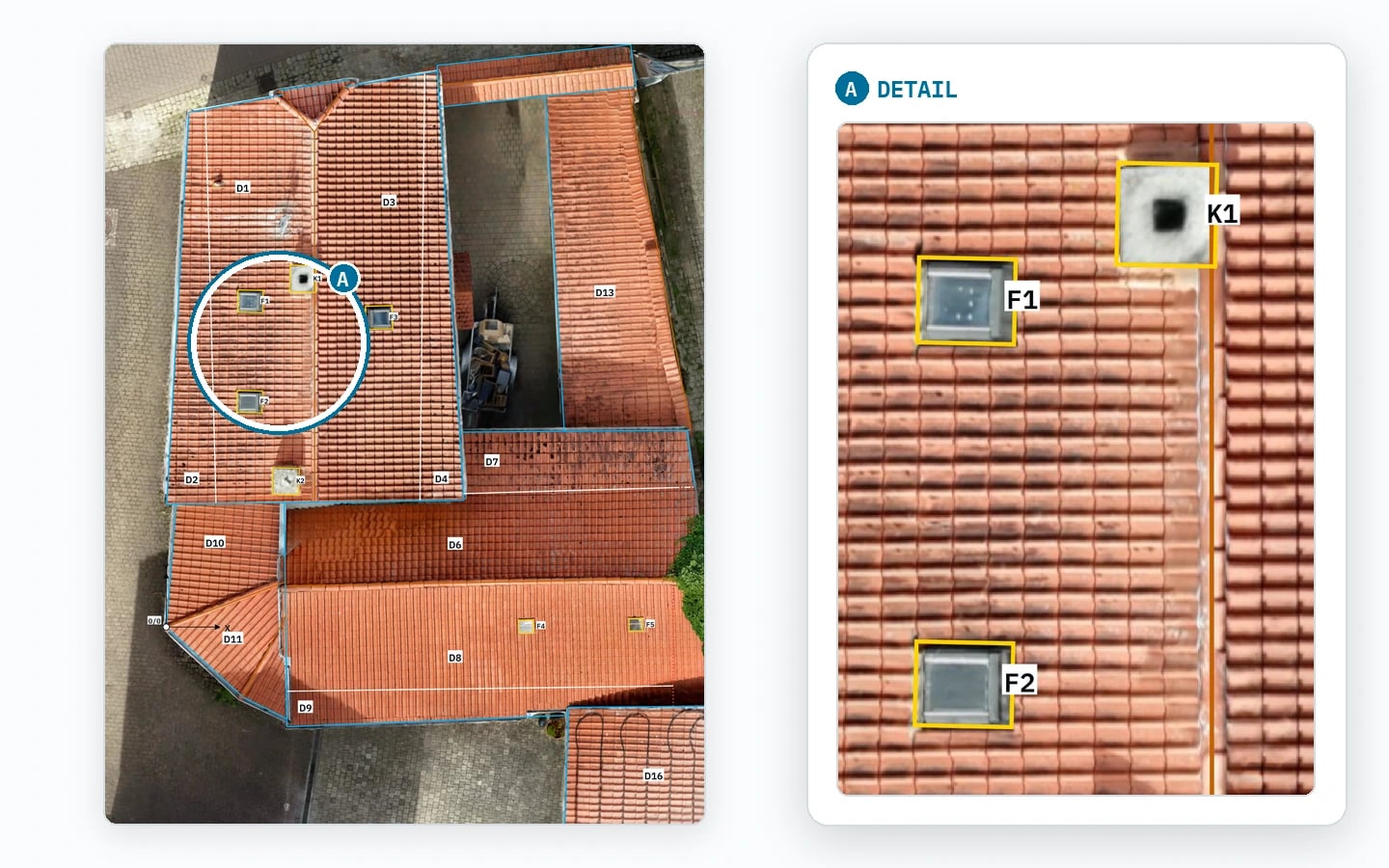
Georeferenced orthophoto
A true-to-scale aerial image as GeoTIFF for QGIS, site plans and area assessment.
Orthophoto · 1 cm per pixel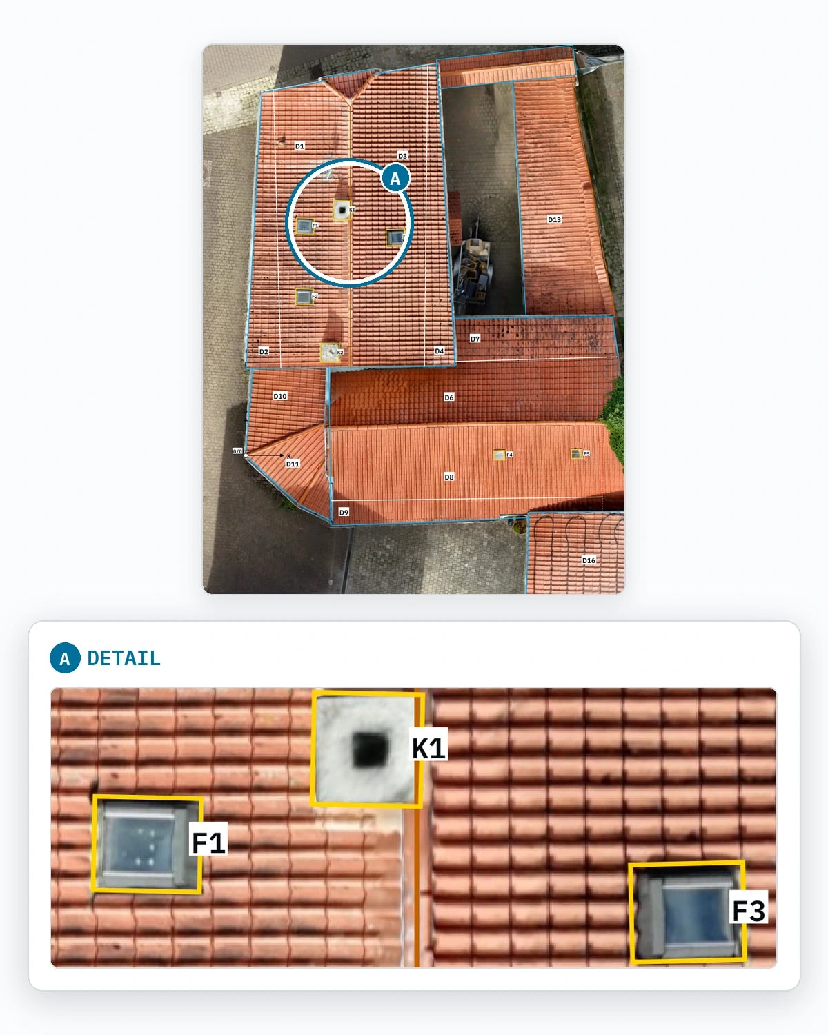
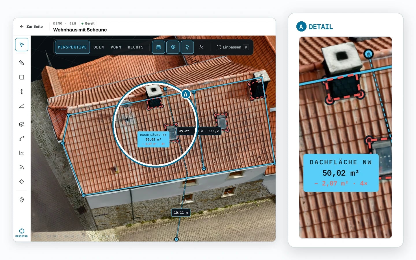
03
Measurements and areas in m²
Roof, facade and plot areas, measurable directly in the 3D viewer.
Screenshot · 3D viewer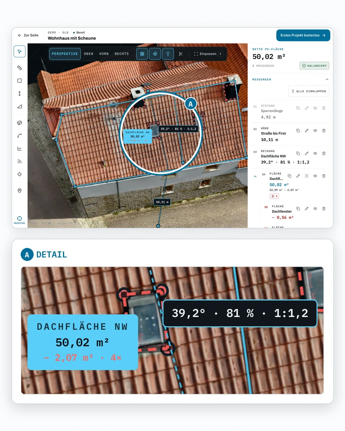
04
Point cloud (LAS/LAZ/E57)
For as-built surveys, volumes and import into CAD and GIS software.
File format · deliveryLAS · LAZ · E5705
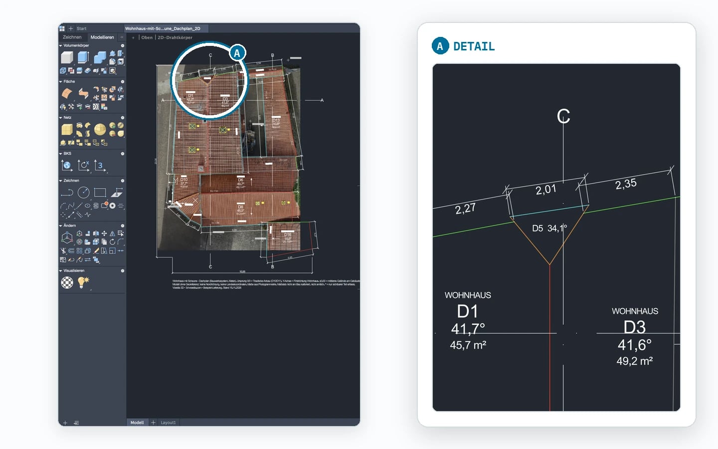
CAD and BIM export
DXF/DWG for AutoCAD, IFC for Revit and ArchiCAD.
Screenshot · DWG in AutoCAD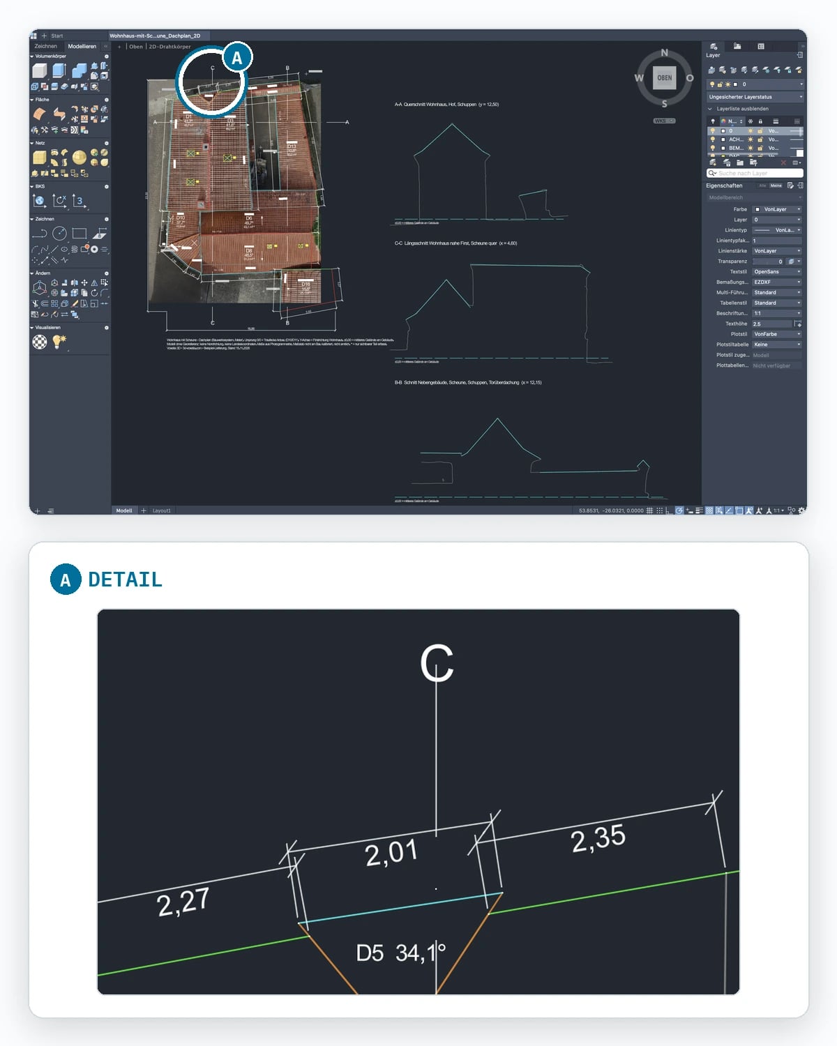
06
PV shading analysis
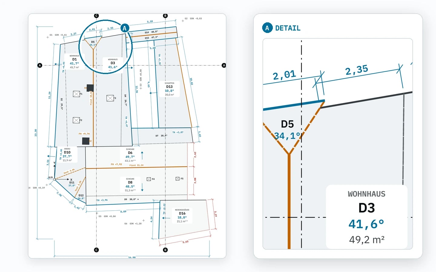
Roof geometry plus shading for solar planning.
Roof planes · plan from a real survey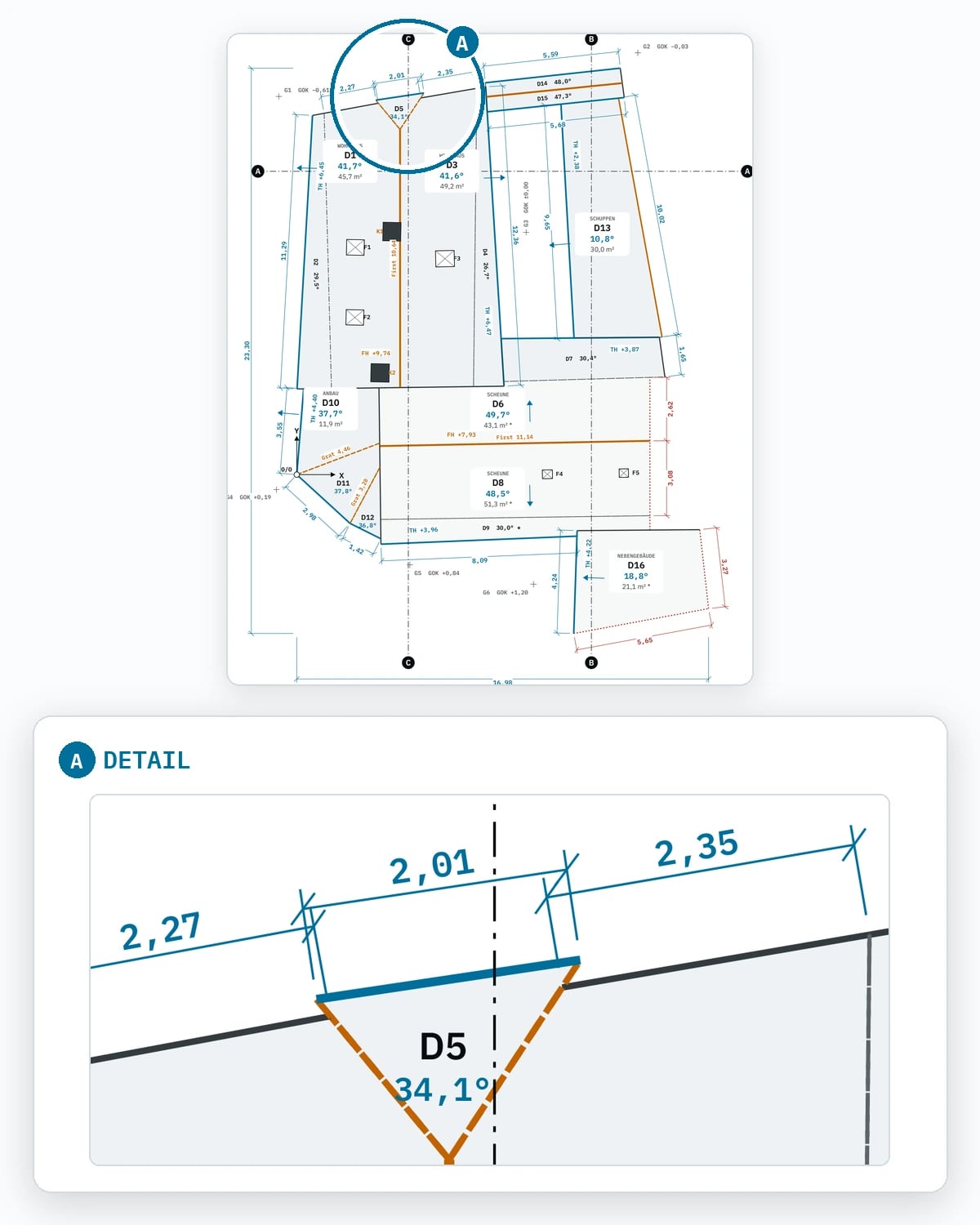
FAQ
Drone surveying in the canton of Jura: what customers ask first.
What does a drone survey cost in the canton of Jura?
Does a drone flight in the canton of Jura need a permit?
How long does a clearance take in the canton of Jura?
When is the best time for a flight in the canton of Jura?
How do I request a flight in the canton of Jura?
From our Oberengstringen base
Neighbouring cantons and all of Switzerland.
Bordering the canton of Jura
Other cantons, by distance
- Zurichtravel incl.
- Zugtravel incl.
- Aargautravel incl.
- Schaffhausentravel incl.
- Thurgautravel incl.
- Lucerne41 km
- Schwyz44 km
- Nidwalden51 km
- Uri59 km
- Glarus60 km
- Appenzell Ausserrhoden60 km
- Obwalden61 km
- Basel-Stadt68 km
- St. Gallen69 km
- Appenzell Innerrhoden70 km
- Grisons101 km
- Fribourg120 km
- Ticino139 km
- Valais158 km
- Vaud170 km
- Geneva222 km
Canton of Jura · +41 78 615 90 58
Prefer to talk?
Call us or write on WhatsApp – we settle site, date and clearance for the canton of Jura on the phone.